Welcome, Guest. Please login or register.
June 23, 2025, 07:18:43 AM

Login with username, password and session length

Recent Topics

[June 22, 2025, 05:13:58 PM]

[June 22, 2025, 11:03:48 AM]

[June 18, 2025, 01:58:02 PM]

[June 13, 2025, 07:00:13 PM]

[June 13, 2025, 02:51:47 PM]

[June 12, 2025, 06:51:40 AM]

[June 06, 2025, 09:02:38 AM]

[June 04, 2025, 11:55:53 AM]

[June 03, 2025, 06:11:22 PM]

[June 02, 2025, 09:56:49 AM]

[June 02, 2025, 09:06:56 AM]

by jed
[May 31, 2025, 12:42:57 PM]

[May 26, 2025, 09:07:51 PM]

[May 25, 2025, 12:50:42 PM]

[May 24, 2025, 08:22:05 PM]

Picture Of The Month


Guess who's back?
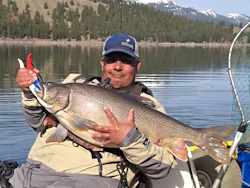
jed with a spring Big Mack

Topic: Legendary Browns Point Ling hole???  (Read 3271 times)

0 Members and 1 Guest are viewing this topic.

Kaptain King

  • Rockfish
  • ****
  • Location: Tacoma
  • Date Registered: Jun 2012
  • Posts: 129
I was down at the Pt. Defiance boat house checking out some gear and shooting the @%#$& with some of the guys and we got to talking about the lingcod opener on May 1st...I was telling the guys I don't have a fish finder yet and I am not going to try and fish for lingcod under the bridge in a kayak...One of the crusty guys said there is an old sunken boat between Dash Point and Browns Point and there are some big lingcod that hang out there. Has anyone else heard of this boat or any other good structure off Browns Point? This was the first I have heard of it...

Tight lines and enjoy the sun this week! Should be some good after work fishing. 


polyangler

  • Sturgeon
  • *******
  • Location: Lacey, WA
  • Date Registered: Jun 2009
  • Posts: 1844
From what I can tell per NOAA charts, there are 3 wrecks between Brown's and Dash Point. Trying to locate them without a FF could prove challenging to say the least though...
[img width=100 height=100]http://i785.photobucket.com/albums/yy131/saltyplastic/NEMrod


IslandHoppa

  • iHoppa
  • Sturgeon
  • *******
  • Location: Camas, WA
  • Date Registered: May 2011
  • Posts: 1914
I use flytomap app for iPhone, found this wreck. May allow you to navigate to your hole. Not sure the link will copy here but the app is cool.


This is a Favorite Place sent from iPhone.

HELP:
Double-click on the .kmz file to open with Google Earth.
Right click on the .kmz file to save on the PC.


Sent by FlyToMap from iPhone.


Buy FlyToMap's Applications from iTunes.
Check www.flytomap.com for details.


Sent from my iPhone


Sent from my iPhone using Tapatalk
iHop

"Of all the things that wisdom provides to help one live one's entire life in happiness, the greatest by far is the possession of friendship." Epicurus

Hobie Tandem Island. OK Tetra 12, Jackson Coosa


Kaptain King

  • Rockfish
  • ****
  • Location: Tacoma
  • Date Registered: Jun 2012
  • Posts: 129
Thanks for the input guys. I will do some research...Need that fish finder though....BAD.


Kola16

  • Rockfish
  • ****
  • <><
  • Location: Arlington, WA
  • Date Registered: Apr 2013
  • Posts: 100
Fishfinders are definitely a plus, but if you go out on May 1st, there will probably be people out there already    ;D
If guns kill people...then pencils misspell words, cars make people drive drunk, and spoons made Rosie O'Donnell fat

"God is great, beer is good, and people are crazy"   -Billy Currington