Welcome, Guest. Please login or register.
May 14, 2025, 05:23:01 AM

Login with username, password and session length

Recent Topics

[May 13, 2025, 07:13:39 PM]

[May 11, 2025, 09:36:38 AM]

[May 08, 2025, 09:53:46 AM]

[May 05, 2025, 09:12:01 AM]

[May 03, 2025, 06:39:16 PM]

by jed
[May 02, 2025, 09:57:11 AM]

[May 01, 2025, 05:53:19 PM]

[April 26, 2025, 04:27:54 PM]

[April 23, 2025, 11:10:07 AM]

by [WR]
[April 23, 2025, 09:15:13 AM]

[April 21, 2025, 10:44:08 AM]

[April 17, 2025, 04:48:17 PM]

[April 17, 2025, 08:45:02 AM]

by jed
[April 11, 2025, 01:03:22 PM]

[April 11, 2025, 06:19:31 AM]

Picture Of The Month


Guess who's back?
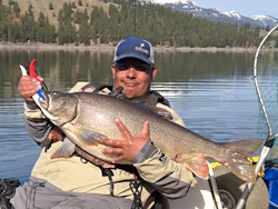
jed with a spring Big Mack

Topic: Questions about retracing Lewis & Clark's route in the mouth of the Columbia  (Read 2622 times)

0 Members and 1 Guest are viewing this topic.

pmmpete

  • Sturgeon
  • *******
  • Location: Missoula, Montana
  • Date Registered: Jul 2013
  • Posts: 1989
I have been following internet posts by a guy who is retracing Lewis and Clark's route from St. Louis to the Pacific Ocean.  He has portaged his kayak past the John Day Dam and is within sight of Mt. Hood.  He is unsure about the hazards of kayaking the mouth of the Columbia, and is wondering if he should take out at some point and hike the end of the route.  Do those of you who regularly do kayak fishing in the mouth of the Columbia have any suggestions, words of wisdom, warnings, or cautionary tales for him about kayaking the mouth of the Columbia?  If you post them here, I'll let him know about this topic.

His web page is http://bucktrack.com/Lewis_and_Clark_Trail.html . His daily posts are interesting and include some nice pictures, and it has been fun to follow his progress.  This web page doesn't have an index with place descriptions which allows you to easily start at the beginning of the trip or at whatever point is of interest to you, but if you go to the very bottom of any of the daily entries, there is a calendar, and you can click on an earlier date, and then page forward through the entries.  There are entries for dates highlighted in turquoise on the calendar.

He started in St. Louis this spring.  Due to the many wing dams in the section of the Missouri above St. Louis, he hiked the first 600 miles to Yankton, South Dakota.  Then he kayaked upstream to Three Forks, Montana.  There are a number of large reservoirs in the Dakotas, and Fort Peck Reservoir in Montana.  Above Fort Peck Reservoir the speed of the river increased, and he spent a lot of time hauling his kayak upstream.  Like Lewis and Clark, he did a 15 mile portage around Great Falls.  From Three Forks he hiked through Dillon, Lemhi pass, Salmon Idaho, and Lolo Montana, followed the Lolo Motorway to Weippe, Idaho, and continued hiking to Orofino, where he resumed paddling down the Clearwater River and the Columbia River.  He recently passed the 3,000 mile point, and as I said earlier, is now below the John Day Dam.

When providing advice, keep in mind that he is in a sit-inside sea kayak, he's by himself, he doesn't have a roll, he doesn't have a dry suit, and he appears to have been doing a lot of kayaking without wearing his spray skirt.
« Last Edit: September 06, 2016, 06:19:21 PM by pmmpete »


Captain Redbeard

  • Lauren
  • Global Moderator
  • Sturgeon
  • *****
  • Location: Portland, OR
  • Date Registered: May 2013
  • Posts: 3327
I hope someone will speak up on this - I know there is some good advice and knowledge out there.

This is a really inspiring task he's undertaken. Thanks for the link - going to read it as I have time.


bsteves

  • Fish Nerd
  • Administrator
  • Sturgeon
  • *****
  • Better fishing through science
  • Location: Portland, OR
  • Date Registered: Feb 2007
  • Posts: 4584
He's going to have strong tides and potentially wind to deal with in the estuary.  The mouth itself (i.e. the Columbia River Bar) is a very serious concern and he will want to contact the Coast Guard for the bar status before attempting.  On a calm ocean day with the right tides it won't be a problem.   

A 1/4 mile portage over Clatsop split would be an easier/safer why to reach the Pacific.

“People say nothing is impossible, but I do nothing every day.”

― A.A. Milne, Winnie-the-Pooh


pmmpete

  • Sturgeon
  • *******
  • Location: Missoula, Montana
  • Date Registered: Jul 2013
  • Posts: 1989
He's going to have strong tides and potentially wind to deal with in the estuary.  The mouth itself (i.e. the Columbia River Bar) is a very serious concern and he will want to contact the Coast Guard for the bar status before attempting.  On a calm ocean day with the right tides it won't be a problem.
Can you suggest any internet resources for information about tides in the section of the Columbia which is affected by tides, and can you provide contact information for the Coast Guard?


Mojo Jojo

  • Sturgeon
  • *******
  • Suffers from Yakfishiolus Catchyitis
  • Location: Tillamook, Oregon
  • Date Registered: May 2014
  • Posts: 6071
Coast guard is on VHF channel 22A and for emergency 16 and in 22A they periodically call out the bar conditions.


Shannon
2013 Jackson Big Tuna "Aircraft Carrier"
2011 Native Mariner Propel "My pickup truck"
2015 Native Slayer Propel "TLW's ride"
20?? Cobra Fish-N-Dive “10yo grandson’s”
20?? Emotion Sparky “5 yr old granddaughter’s”


pmmpete

  • Sturgeon
  • *******
  • Location: Missoula, Montana
  • Date Registered: Jul 2013
  • Posts: 1989
Coast guard is on VHF channel 22A and for emergency 16 and in 22A they periodically call out the bar conditions.
He doesn't have a VHF radio.


Mojo Jojo

  • Sturgeon
  • *******
  • Suffers from Yakfishiolus Catchyitis
  • Location: Tillamook, Oregon
  • Date Registered: May 2014
  • Posts: 6071
Coast guard is on VHF channel 22A and for emergency 16 and in 22A they periodically call out the bar conditions.
He doesn't have a VHF radio.
Wow that far with no VHF
« Last Edit: September 06, 2016, 12:22:23 PM by Mojo Jojo »


Shannon
2013 Jackson Big Tuna "Aircraft Carrier"
2011 Native Mariner Propel "My pickup truck"
2015 Native Slayer Propel "TLW's ride"
20?? Cobra Fish-N-Dive “10yo grandson’s”
20?? Emotion Sparky “5 yr old granddaughter’s”


Lee

  • Iris
  • Sturgeon
  • *******
  • Fuck Cancer!
  • Location: Graham, WA
  • Date Registered: Jul 2009
  • Posts: 6091
If he crosses the bar, should do so on North side at slack to incoming tide. The mouth of the Columbia is not what it was when L&C made the trip. If personally land on the South side at handicap beach and portage to the beach on the ocean side.

Sent from my VS987 using Tapatalk


Lee

  • Iris
  • Sturgeon
  • *******
  • Fuck Cancer!
  • Location: Graham, WA
  • Date Registered: Jul 2009
  • Posts: 6091


Trident 13

  • Salmon
  • ******
  • Location: Kent
  • Date Registered: Jul 2016
  • Posts: 791
Here is the link, didn't see the actual link on the coast guard picture.  You can get web cam live, but it could change before he could fold up and get there!

https://www.uscg.mil/d13/sectcolrvr/

I checked with a retired coast guard officer.  Its very unlikely CG will give any advice due to liability issues.  Many here might quickly say he's not ready for it even if he makes it.  Given all of the caveats already mentioned, he could be in for a dangerous ride, and might not realize it looks good until he realizes he was looking just before the tide swing.  Again, based only on what's posted, he's paddling WAY outside the box many would, and I take as many chances as anyone sometimes, but in known situations.  Off course, Lewis and Clark didn't have any of this stuff and they did make it (right?)  Good luck, heck of a journey.
« Last Edit: September 06, 2016, 05:23:52 PM by Trident 13 »


rawkfish

  • ORC
  • Sturgeon
  • *
  • Cabby Strong!
  • youtube.com
  • Location: Portland
  • Date Registered: Mar 2009
  • Posts: 4731
Hopefully he doesn't get pinned down in some "Dismal little nitch" by a gnarly 6-day November storm.   ;D
                
2011 Angler Of The Year
1st Place 2011 PDX Bass Yakin' Classic
"Fishing relaxes me.  It's like yoga except I still get to kill something."  - Ron Swanson


pmmpete

  • Sturgeon
  • *******
  • Location: Missoula, Montana
  • Date Registered: Jul 2013
  • Posts: 1989
Buck has been making some impressive daily mileages when not pinned down by wind, so weather permitting, he should be past Portland and arriving in the estuary pretty quickly.  During this trip he has been doing a lot of paddling on big reservoirs where high winds and big waves are a frequent problem.  It seems to me that it would be helpful to provide him with information about specific hazards which may exist in the estuary which are different from just paddling down the Columbia and across its reservoirs, and suggestions about where it might be a good idea to stop paddling.  Is going past the Clatsop Spit and crossing the bar into the ocean the primary risk, or are there other hazards in the estuary which he should know about?
« Last Edit: September 06, 2016, 06:17:35 PM by pmmpete »


RoxnDox

  • Salmon
  • ******
  • Native Propel
  • Location: Gig Harbor, WA
  • Date Registered: Sep 2013
  • Posts: 677
Buck has been making some impressive daily mileages when not pinned down by wind, so weather permitting, he should be past Portland and arriving in the estuary pretty quickly.  During this trip he has been doing a lot of paddling on big reservoirs where high winds and big waves are a frequent problem.  It seems to me that it would be helpful to provide him with information about specific hazards which may exist in the estuary which are different from just paddling down the Columbia and across its reservoirs, and suggestions about where it might be a good idea to stop paddling.  Is going past the Clatsop Spit and crossing the bar into the ocean the primary risk, or are there other hazards in the estuary which he should know about?

Pete, one link from the Coasties web page that he might find useful:  https://www.uscg.mil/d13/sectcolrvr/docs/columbiariverdangerareas.pdf

Jim
Junk Jigs "BEST USE OF ACTUAL JUNK" category - "That tape should have been a prized possession and not junk. That will be a collectors item in 30 years!” & “There sure is a lot of junk in there.”


pmmpete

  • Sturgeon
  • *******
  • Location: Missoula, Montana
  • Date Registered: Jul 2013
  • Posts: 1989
RoxnDox, thanks for the link to the hazards map - that's real useful.  Are there navigation maps for further up the estuary and the Columbia which are available on the internet?

bsteves, Lee, and others who regularly fish this area - If the weather is good, do you think that Buck could sneak along the south side of the estuary to the Clatsop Spit without excessive risk from currents and waves, and then portage across the spit for some triumphant pictures of him and his kayak on the beach, looking out at the Pacific Ocean?  Or do you recommend that he take out further upstream, and not try to cross the estuary?


Lee

  • Iris
  • Sturgeon
  • *******
  • Fuck Cancer!
  • Location: Graham, WA
  • Date Registered: Jul 2009
  • Posts: 6091
The estuary is fine, the bar is not. Every navigation map I've seen shows the breakers just west of the point I provided earlier. I recommend he doesn't go past that and portage there. Realistically, that's where the coast would have been back in the day anyway.

Sent from my VS987 using Tapatalk