
Welcome, Guest. Please login or register.
September 28, 2026, 12:19:41 PM

Login with username, password and session length

Recent Topics

[September 12, 2026, 10:21:13 PM]

[September 10, 2026, 07:02:35 AM]

[September 08, 2026, 08:56:45 AM]

by jed
[August 21, 2026, 05:45:53 PM]

[August 21, 2026, 04:28:27 PM]

[August 20, 2026, 08:30:22 PM]

[August 20, 2026, 07:10:29 PM]

[August 11, 2026, 04:33:52 PM]

[August 09, 2026, 11:33:18 AM]

[August 09, 2026, 11:31:45 AM]

[August 07, 2026, 05:09:12 PM]

by jp52
[August 03, 2026, 05:06:39 PM]

[July 31, 2026, 08:40:54 AM]

[July 30, 2026, 03:52:25 PM]

by [WR]
[July 27, 2026, 10:08:05 AM]
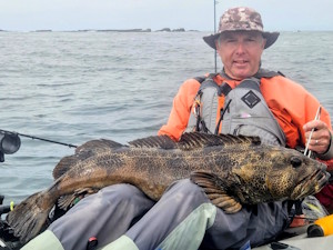
Picture Of The Month


2025 & 2026 AOTD champ Nobaddays
with a trophy lingcod

Topic: feeder chinook  (Read 8233 times)

0 Members and 1 Guest are viewing this topic.

Hocuspik

  • Krill
  • *
  • Location: Chilliwack BC
  • Date Registered: Mar 2016
  • Posts: 15
G Day. I'm thinking of getting out at ambleside for some feeder (winter) chinook this December. I have tried to find a depth chart pertaining to the area but haven't had any luck. Where would one find this info? Has anyone fished this time of year? Any info would be helpful as I have not had much salt experience in a kayak. Would fish the incoming tide. I'm still in the process of getting setup for this adventure.


Tinker

  • Sturgeon
  • *******
  • Kevin
  • Location: 42.74°N 124.5°W
  • Date Registered: May 2013
  • Posts: 3338
There are some official government maps online, but they charge for them.  I'm not familiar with Ambleside, but there's a map of the western side of Vancouver at https://www.waterproperties.ca/maps/wcvi_stations.php.  Hope that's of any help.
The fish bite twice a day - just before we get here and right after we leave.