Welcome, Guest. Please login or register.
October 08, 2026, 12:14:34 AM

Login with username, password and session length

Recent Topics

[October 07, 2026, 06:00:20 AM]

[September 29, 2026, 12:06:23 PM]

[September 12, 2026, 10:21:13 PM]

[September 10, 2026, 07:02:35 AM]

[September 08, 2026, 08:56:45 AM]

by jed
[August 21, 2026, 05:45:53 PM]

[August 21, 2026, 04:28:27 PM]

[August 20, 2026, 08:30:22 PM]

[August 20, 2026, 07:10:29 PM]

[August 11, 2026, 04:33:52 PM]

[August 09, 2026, 11:33:18 AM]

[August 09, 2026, 11:31:45 AM]

[August 07, 2026, 05:09:12 PM]

by jp52
[August 03, 2026, 05:06:39 PM]

[July 31, 2026, 08:40:54 AM]

Picture Of The Month


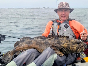
2025 & 2026 AOTD champ Nobaddays
with a trophy lingcod

Topic: Google Earth underwater contours  (Read 3792 times)

0 Members and 1 Guest are viewing this topic.

demonick

  • Sturgeon
  • *******
  • Domenick Venezia, Author
  • Date Registered: Apr 2009
  • Posts: 2835
Something I found a while back and may have mentioned in passing, but which is interesting enough to explicitly mention.

Google Earth has always had underwater contour data, but it was not displayable.  Mousing over water displayed the negative elevation so it was clear the data was there.  In either version 5 or 6 Google Earth added an underwater feature.  If you dive below the surface and then tilt the view to horizontal you will get an underwater view.  Another way to do this is to drag the Street View icon onto the water. 

Try both ways to visualize the contour data as they behave differently.  You may need to increase the elevation exaggeration. 
demonick
Author, Linc Malloy Legacies -- Action/Adventure/Thrillers
2021 Chanticleer Finalist - Global Thriller Series & High Stakes Fiction
Rip City Legacy, Book 6 latest release!
DomenickVenezia.com


craig

  • Sturgeon
  • *******
  • Location: Tualatin, OR
  • Date Registered: Jul 2008
  • Posts: 3819
I was only able to use it far off shore.  Not in the areas I normally fish.  It is cool, though.


anything