Welcome, Guest. Please login or register.
June 21, 2025, 01:04:09 PM

Login with username, password and session length

Recent Topics

[Today at 10:00:18 AM]

[June 18, 2025, 01:58:02 PM]

[June 13, 2025, 07:00:13 PM]

[June 13, 2025, 02:51:47 PM]

[June 12, 2025, 06:51:40 AM]

[June 06, 2025, 09:02:38 AM]

[June 04, 2025, 11:55:53 AM]

[June 03, 2025, 06:11:22 PM]

[June 02, 2025, 09:56:49 AM]

[June 02, 2025, 09:06:56 AM]

by jed
[May 31, 2025, 12:42:57 PM]

[May 26, 2025, 09:07:51 PM]

[May 25, 2025, 12:50:42 PM]

[May 24, 2025, 08:22:05 PM]

[May 22, 2025, 05:09:07 PM]

Picture Of The Month


Guess who's back?
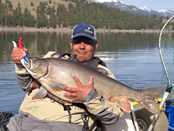
jed with a spring Big Mack

Topic: Phone Apps....????  (Read 2601 times)

0 Members and 1 Guest are viewing this topic.

sandsquirt

  • Perch
  • ***
  • Location: St. Helens,Ore.
  • Date Registered: May 2011
  • Posts: 59
I just found a phone app for the iphone that I will use quite abit. It's called Fishing Spots. It is a free app that has message boards and maps out local fishing areas. There is also a pro version that has tide tables and weather. There is not a bunch of local users yet, but maybe soon. It is worth the free price tag. Does anybody else have a favorite.
P.S. They also have a kayak fishing thread.


crazyeyes

  • Perch
  • ***
  • 2011 Hobie Adventure
  • Location: Battle Ground, Wa.
  • Date Registered: Feb 2011
  • Posts: 90
Check out the Navionics phone app, it's well worth the $9.99,  has built in tide and current info, and all the Navionics maps. 
If it wasn't for flashbacks, I'd have no memories at all.


sandsquirt

  • Perch
  • ***
  • Location: St. Helens,Ore.
  • Date Registered: May 2011
  • Posts: 59
Will do. Thanks.


DVO

  • Plankton
  • *
  • Location: Victoria, British Columbia
  • Date Registered: Aug 2011
  • Posts: 5
Three that I use are:

Fishing Status Lite - Species database, tide tables, moon-phase predictions - hotspots - weather - etc....

Fishtime Lite - Free App that tells the best times of day to fish based on the moon phase (if you dig that kind of thing...)

iNavX - Chartplotter function for your iphone, comes with US charts and some Canadian coastal \ great lakes areas. Amazing piece of kit, and worth the $50 price tag.


DVO

  • Plankton
  • *
  • Location: Victoria, British Columbia
  • Date Registered: Aug 2011
  • Posts: 5
iGIS for the iPhone.

It's a GIS software package that tracks your position and gives you basic GIS editting tools and functions on Google maps background. It doesn't give you chart and depth data for the water, but as a simple Nav tool, it's free and it accepts GIS format mapping data if you happen to be a cartographer for a living...like me! Basically, it will track your position as you move, with the google imagery as a backdrop.


anything