Welcome, Guest. Please login or register.
May 14, 2025, 04:58:48 AM

Login with username, password and session length

Recent Topics

[May 13, 2025, 07:13:39 PM]

[May 11, 2025, 09:36:38 AM]

[May 08, 2025, 09:53:46 AM]

[May 05, 2025, 09:12:01 AM]

[May 03, 2025, 06:39:16 PM]

by jed
[May 02, 2025, 09:57:11 AM]

[May 01, 2025, 05:53:19 PM]

[April 26, 2025, 04:27:54 PM]

[April 23, 2025, 11:10:07 AM]

by [WR]
[April 23, 2025, 09:15:13 AM]

[April 21, 2025, 10:44:08 AM]

[April 17, 2025, 04:48:17 PM]

[April 17, 2025, 08:45:02 AM]

by jed
[April 11, 2025, 01:03:22 PM]

[April 11, 2025, 06:19:31 AM]

Picture Of The Month


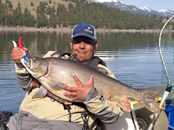
Guess who's back?
jed with a spring Big Mack

Topic: Elk River - floating the lowest stretch?  (Read 2671 times)

0 Members and 1 Guest are viewing this topic.

thundercleez

  • Herring
  • **
  • Location: United States
  • Date Registered: Feb 2015
  • Posts: 25
Hey so I wanna get down to the Elk after hopefully we get a bunch of rain tomorrow and the next.  Looking at launching at Iron Head or the RV park slightly upriver and going down to the tidewater section or the river.  I heard there is 4wd access near the mouth, but I've never been there. 

Anyone ever done this section on a yak?  Is it easily doable?  It seems like an easy river from my reading but my main concern is just the take out. 


C_Run

  • Sturgeon
  • *******
  • Location: Independence, OR
  • Date Registered: Apr 2011
  • Posts: 1239
You drive on the beach for about a mile from the south end of Cape Blanco State Park. Drive through the camping loop and look for the sign "to beach" to the left. People get vehicles stuck there often so I guess 4WD would be recommended. Yes, people take drift boats down that route sometimes.

Consider doing Sixes from the access by Hughes House historic house. There are probably two miles+ of water you can paddle either towards the mouth or upstream and some great holes.
« Last Edit: November 15, 2015, 04:45:09 AM by C_Run »


thundercleez

  • Herring
  • **
  • Location: United States
  • Date Registered: Feb 2015
  • Posts: 25
Thanks a lot c_run. I'll have to look for the historic house and check it out.


Tinker

  • Sturgeon
  • *******
  • Kevin
  • Location: 42.74°N 124.5°W
  • Date Registered: May 2013
  • Posts: 3338
You CANNOT LEGALLY DRIVE ANY VEHICLE ON THE BEACH from Cape Blanco State Park unless you have disability tags.  It's posted.  Don't do it.  Every so often the Rangers patrol the beach and the fine is substantial.

You can, however, drive the beach from Paradise Point north to the Elk.

I surely hope you get this in time.

Put that book back on the shelf before it turns you into a statistic.  If the lower Elk were easy, the Guides would drift it every day and twice on Sundays.  These are my home waters and they are not "easy" rivers at normal flow - and they'll rip you a new one when they're up.  Last year's floods deposited some hairy snarls and snags down there and the land owners are very protective - if you have to get out early, they may not be welcoming.

I agree completely with C_Run's suggestion to try the Sixes instead of the lower Elk.  Either launch at the Hughes House and work the holes up and downstream from there, or launch at the US 101 bridge (the Sixes Grange) and take out at Hughes House.

We got quite a bit of rain over the last 24 hours, and I'd chance the pools and holes around the Hughes House right now, but I wouldn't run either river because you're not going to find slack water, and there's no way you're going to be able to paddle upstream against the current.  Think "bobsled run" for the next three or four days...

Be careful.

If you live in this area, we should meet up and chat.  Send a PM.


« Last Edit: November 16, 2015, 12:40:41 AM by Tinker »
The fish bite twice a day - just before we get here and right after we leave.


C_Run

  • Sturgeon
  • *******
  • Location: Independence, OR
  • Date Registered: Apr 2011
  • Posts: 1239
Thanks for that, Tinker. I did not know it was not legal since you see people driving out there this time of year.  Two years ago we were showing our friends around during winter and a guy came up the steep road by the beach parking lot frantically waving as we were leaving. He had driven out to the mouth to pick agates and his truck was stuck in the sand with the tide coming in. (Won't mention names but one of your townspeople). We spent the next hour driving him around the town looking for someone with an appropriate vehicle that could pull him out. The wife called him up a day later to see how it played out and apparently they did get the rig out as the water was rising around the bottom of his truck. He lucked out because we were the only ones around that day.


thundercleez

  • Herring
  • **
  • Location: United States
  • Date Registered: Feb 2015
  • Posts: 25
Thanks for that bit of help Tinker. I'm up in the Coos area and the Elk and Sixes seem like great opportunities for salmon that I unfortunately just don't have earlier in the year due to my job and having to live inland.  It's my 2nd winter here and I definitely want to fish some of these southern streams, just want to develop a plan before I go down there. Definitely going to scout it out and do some bank fishing before I attempt a float. Any and all pointers would be helpful and maybe we can meet up and fish.
« Last Edit: November 16, 2015, 11:45:28 AM by thundercleez »


Tinker

  • Sturgeon
  • *******
  • Kevin
  • Location: 42.74°N 124.5°W
  • Date Registered: May 2013
  • Posts: 3338
Yeah, C - the signs are posted on the message board up by the paved parking area.  When we were talking to a Ranger who'd stopped and ticketed someone driving around the beach, I was told it's because folks were hauling out truckloads of interesting driftwood for re-sale, so they closed the beach.  At about the same time, the signs that had been posted at Paradise Point were removed.

Thundercleez, sure.  Chat on.  I could use a new river-running partner.
The fish bite twice a day - just before we get here and right after we leave.


C_Run

  • Sturgeon
  • *******
  • Location: Independence, OR
  • Date Registered: Apr 2011
  • Posts: 1239
So, are the fishermen still driving down there?  I saw a few vehicles there last month. Getting a kayak from the mouth of Elk River to civilization is a dilemma I have contemplated myself more than once.

There used to be acres of driftwood on the beaches back in the 60's and 70's and now there isn't much. It doesn't get replenished with the reduction of logging. I actually helped take wood off that beach once but that was for home heating.
« Last Edit: November 16, 2015, 04:49:06 PM by C_Run »


Tinker

  • Sturgeon
  • *******
  • Kevin
  • Location: 42.74°N 124.5°W
  • Date Registered: May 2013
  • Posts: 3338
C - yeah, folks still drive on the Cape Blanco Beach and they still get ticketed when the Rangers are around.  I think they're counting on not getting caught, since more folks have been hiking down from the park than driving down these days.  More drive up from Paradise Point since they opened-up vehicle beach access there.  That's a tricky drive, IMHO, because you have to weave around the softer sand.  Mostly, trucks with big fat tires and ATV's enter from Paradise Point.

I'm not an expert on this, but I believe the signs say that you can gather driftwood from the State's beaches for personal use, but you cannot take it to be resold.  My memory isn't all that it could be, but I'm pretty sure that's what the signs say.  Now did you use that wood yourself or did you sell it?  'Fess up.  You can call me Judas if you want, but I could use a bit of reward money for my new kayak.

The fish bite twice a day - just before we get here and right after we leave.


C_Run

  • Sturgeon
  • *******
  • Location: Independence, OR
  • Date Registered: Apr 2011
  • Posts: 1239
I and some other teenaged cohorts once removed a load of firewood for one of the pillars of the community back in the day.

I'd never take my truck down there. That would be too adventurous. I'll walk. That would be a long way to carry a fish, though, wouldn't it?


Tinker

  • Sturgeon
  • *******
  • Kevin
  • Location: 42.74°N 124.5°W
  • Date Registered: May 2013
  • Posts: 3338
Rats!  Statute of Limitations has probably passed.

What I've seen is that folks are wearing sizeable backpacks when they hike down.  I wondered how much tackle a person needed before I was smart enough to notice that the packs are mostly empty.  But I believe I'd rather hike out to the mouth of the Sixes than hike to the mouth of the Elk - from either direction.

Thundercleez, if you time your take-out for a low tide, the drive from Paradise Point on the wet sand isn't so tricky - but even driving the wet, packed sand will get tricky soon, when the storms pick up and sculpt the beach into deep scallops.

I've heard that the stretch from the RV Park (or Ironhead) to the 101 bridge can be pretty productive for salmon and it's mostly untouched water.  It would be a heck of a climb getting a kayak up to 101 from under the bridge - two people could do it - and a strong paddler could get back up to Ironhead to take out.

There, I haven't totally hijacked the thread.  I feel better.
The fish bite twice a day - just before we get here and right after we leave.


C_Run

  • Sturgeon
  • *******
  • Location: Independence, OR
  • Date Registered: Apr 2011
  • Posts: 1239
I met a guy in a sink coming downstream at Ironhead last fall but the water was not all that high at the time.He took out there.