Welcome, Guest. Please login or register.
July 07, 2025, 01:33:10 PM

Login with username, password and session length

Recent Topics

by Noah
[Today at 11:54:03 AM]

[Today at 08:41:33 AM]

[July 04, 2025, 07:58:22 AM]

[July 01, 2025, 08:55:15 AM]

[July 01, 2025, 06:42:20 AM]

[July 01, 2025, 04:40:08 AM]

[June 28, 2025, 03:25:42 PM]

[June 26, 2025, 11:15:57 PM]

[June 25, 2025, 02:09:58 PM]

[June 24, 2025, 02:37:40 AM]

[June 22, 2025, 11:03:48 AM]

[June 13, 2025, 07:00:13 PM]

[June 13, 2025, 02:51:47 PM]

[June 12, 2025, 06:51:40 AM]

[June 06, 2025, 09:02:38 AM]

Picture Of The Month


Guess who's back?
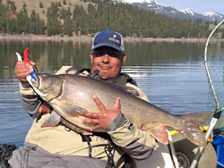
jed with a spring Big Mack

Topic: Cook Inlet King Special Harvest Area .gpx file  (Read 2413 times)

0 Members and 1 Guest are viewing this topic.

Low_Sky

  • Salmon
  • ******
  • Location: Anchorage, AK
  • Date Registered: Oct 2015
  • Posts: 521
I made a .gpx file of the 1-mile line and waypoints of the approximate locations of the conservation zones.  The conservation zone waypoints were created with the descriptions given in the reg book, so give them a healthy buffer because the orange markers on the beach may be slightly off from where the regs say they are (I'd count on that). 

To use the file, you'll have to save it to your computer, change the .txt file extension to .gpx (just rename it), and follow your fish finder's instructions for importing tracks and waypoints.  I got this to work on my Raymarine Dragonfly 7, but I had to update the software to do it.  Raymarine has their own navigation computer program and file extension (.fsh), but the new software versions let you use .gpx files too. 

The image here is what you'll get in the .gpx, as seen in Google Earth. 
« Last Edit: June 17, 2016, 01:20:47 PM by Low_Sky »
2016 Hobie Revolution 16
2014 Perception Triumph 13


kardinal_84

  • Sturgeon
  • *******
  • Perseverance Pays!
  • Kayak Fishing Southcentral Alaska
  • Location: Anchorage, AK
  • Date Registered: Mar 2011
  • Posts: 4216
awesome. thanks!!!!

Sent from my SAMSUNG-SM-G890A using Tapatalk

Personal Chauffeur for Kokatat & Hobie Fishing Team member, Ryu .

Personal fishing sites of Alaska Kayak Angling adventures of my son and I. I am NOT a guide.
guidesak.blogspot.com
AlaskaKayakFisher.com


Low_Sky

  • Salmon
  • ******
  • Location: Anchorage, AK
  • Date Registered: Oct 2015
  • Posts: 521
I fished with this .gpx file on my machine on Saturday and it was great. On Sunday I left the fish finder on the beach due to low battery, and ended up drifting into one of the conservation zones, oops! If you fish WG while the Special Harvest Area is in effect and have a GPS fish finder, installing this file is well worth your time. It's also great for quickly estimating your distance from shore, because you can compare your position to the 1-mile line at a glance.


Sent from my iPhone using Tapatalk
2016 Hobie Revolution 16
2014 Perception Triumph 13


anything