Welcome, Guest. Please login or register.
June 04, 2024, 01:22:42 AM

Login with username, password and session length

Recent Topics

[June 03, 2024, 06:03:03 PM]

[June 03, 2024, 03:35:37 PM]

[June 03, 2024, 03:08:01 PM]

[June 03, 2024, 01:37:54 PM]

[June 02, 2024, 08:07:13 AM]

[June 02, 2024, 06:31:12 AM]

[June 02, 2024, 06:30:19 AM]

[May 31, 2024, 09:49:03 AM]

[May 30, 2024, 09:48:30 AM]

[May 30, 2024, 09:40:29 AM]

[May 29, 2024, 02:46:19 PM]

[May 29, 2024, 01:49:12 PM]

[May 29, 2024, 11:59:33 AM]

[May 29, 2024, 11:42:05 AM]

[May 29, 2024, 11:40:13 AM]

Picture Of The Month


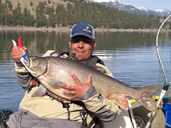
BigFishy with a big springer!

Topic: Map Tool for Smoke Forecasts  (Read 2728 times)

0 Members and 1 Guest are viewing this topic.

Beachmaster90

  • Rockfish
  • ****
  • Location: Creswell, OR
  • Date Registered: Feb 2015
  • Posts: 131
Hope everyone is out getting after it this weekend.

Here's a great tool for checking air quality if you're considering heading out into the smoke. Windy.com is also a great tool for wind and swell forecasts if you haven't played around with it.

Stay safe!!!

https://www.huntfishharvest.com/2020/09/12/checking-air-quality-how-to-forecast-smoke-with-windy-com/


Stinger Hook

  • Lingcod
  • *****
  • Location: Hillsboro, OR
  • Date Registered: Sep 2015
  • Posts: 252
Thank you for the link! I never checked windy.com before and it seems like a very useful site. If accurate then the Oregon coast should see a lot improvement tomorrow.


Cackalacky

  • Perch
  • ***
  • Location: NW Oregon
  • Date Registered: Mar 2020
  • Posts: 79
Man, I am so impressed with that site! It does almost everything I want it to. Now I just need them to add a deep zoom like current map and it'll be all I look at. Thanks for sharing/writing this up.


anything