Welcome, Guest. Please login or register.
August 22, 2025, 03:27:30 PM

Login with username, password and session length

Recent Topics

[August 20, 2025, 01:02:31 PM]

[August 19, 2025, 08:25:11 AM]

by PNW
[August 16, 2025, 10:51:59 AM]

[August 15, 2025, 05:52:58 PM]

[August 12, 2025, 06:14:41 PM]

[August 08, 2025, 12:28:19 PM]

[August 08, 2025, 11:19:57 AM]

[August 08, 2025, 11:11:23 AM]

[August 08, 2025, 10:59:41 AM]

[August 07, 2025, 07:03:21 AM]

by jed
[August 05, 2025, 07:31:48 PM]

[August 02, 2025, 05:52:47 PM]

[July 30, 2025, 08:15:00 AM]

[July 28, 2025, 04:41:44 PM]

[July 18, 2025, 08:03:26 PM]

Picture Of The Month


Guess who's back?
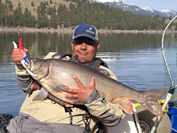
jed with a spring Big Mack

Topic: Google Earth - Lake/River/Stream names  (Read 13827 times)

0 Members and 1 Guest are viewing this topic.

demonick

  • Sturgeon
  • *******
  • Domenick Venezia, Author
  • Date Registered: Apr 2009
  • Posts: 2835
I love Google Earth, although they seemed to have removed some of my favorite features in the latest version such as mountain names.  One thing GE has always lacked was labels for bodies of water.  Yes, there was a stock Hydrographic Features option than outlined lakes with a blue line - yawn, but no labels.

http://www.geonames.org/  provides a handy search engine for all global names.

More specifically, the link below provides a link to a .kml file you can load into GE.  Right click and save on the "geonames features network link" which is at the end of the first post.

http://geonames.wordpress.com/2006/08/06/google-earth/

Start GE, then double click the "feature-networklink.kml" file you downloaded.  "Geonames" will load into your Temporary Places.  Open the hierarchy tree and choose "Hydrographic Features".  Also play with the Hypsographic and Undersea Features while salt water is in view.

« Last Edit: July 08, 2010, 08:21:47 AM by demonick »
demonick
Author, Linc Malloy Legacies -- Action/Adventure/Thrillers
2021 Chanticleer Finalist - Global Thriller Series & High Stakes Fiction
Rip City Legacy, Book 6 latest release!
DomenickVenezia.com


FishSniffer

  • Lingcod
  • *****
  • Hobie Mirage Adv., Outback SUV, OK Scrambler XT's
  • Midcoast Chapter of Northwest Steelheaders
  • Location: Newport, OR
  • Date Registered: Apr 2008
  • Posts: 400


demonick

  • Sturgeon
  • *******
  • Domenick Venezia, Author
  • Date Registered: Apr 2009
  • Posts: 2835
I've been playing with Geonames in GE for a while.  One key is to leave the main folder UNCHECKED until you need it because it clutters and slows GE.  After installation the Geonames folder opens to 9 subfolders.  Topographic features are under Hypsographic Features, Spot Features, and Area Features.  For example in a thread NANOOK said:

Fish right off the NE tip of Upright Head for nookies within 100yds of the point, and due North from there just E of Foster Point on Orcas

Viewing the area in GE, expanding the Geonames folder, and checking Spot Features displays a Foster Point label.  Checking Hypsographic Features displays an Upright Head label.  Clicking on the label brings up some information and links.
demonick
Author, Linc Malloy Legacies -- Action/Adventure/Thrillers
2021 Chanticleer Finalist - Global Thriller Series & High Stakes Fiction
Rip City Legacy, Book 6 latest release!
DomenickVenezia.com