Welcome, Guest. Please login or register.
May 12, 2025, 04:51:06 AM

Login with username, password and session length

Recent Topics

[May 11, 2025, 09:36:38 AM]

[May 08, 2025, 09:53:46 AM]

[May 05, 2025, 09:12:01 AM]

[May 03, 2025, 06:39:16 PM]

by jed
[May 02, 2025, 09:57:11 AM]

[May 01, 2025, 05:53:19 PM]

[April 26, 2025, 04:27:54 PM]

[April 23, 2025, 11:10:07 AM]

by [WR]
[April 23, 2025, 09:15:13 AM]

[April 21, 2025, 10:44:08 AM]

[April 17, 2025, 04:48:17 PM]

[April 17, 2025, 08:45:02 AM]

by jed
[April 11, 2025, 01:03:22 PM]

[April 11, 2025, 06:19:31 AM]

[April 07, 2025, 07:03:34 AM]

Picture Of The Month


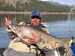
Guess who's back?
jed with a spring Big Mack

Topic: Droid Apps for us!!  (Read 2465 times)

0 Members and 1 Guest are viewing this topic.

[WR]

  • Sturgeon
  • *******
  • VFW, Life Member at Large, since 1997.
  • ADTA.org
  • Location: currently 17844/17837
  • Date Registered: Jan 2008
  • Posts: 4747
Lets face it, Droid users are steadily gaining apps but the big company competitor has a lock on some.

What I want to do here is start a list for members to reference in order to help them maximize their time on the water. Anyone can add to this, or send it to me and I'll add it... Mods permission of course.

I'll start. today i found this one. Though its for a vendor in Texas, it gives you a great way to find launch points.

http://www.austinkayak.com/app

and for tidal currents on all 3 coasts;

https://market.android.com/details?id=com.yoyana.Currents&feature=also_installed#?t=W251bGwsMSwyLDEwNCwiY29tLnlveWFuYS5DdXJyZW50cyJd
« Last Edit: March 02, 2012, 02:53:32 PM by [WR] »
As of July 12th, I am, officially,  retired.


Lee

  • Iris
  • Sturgeon
  • *******
  • Fuck Cancer!
  • Location: Graham, WA
  • Date Registered: Jul 2009
  • Posts: 6091


  • Don't ask me how I know!
  • Date Registered: Nov 2006
  • Posts: 1704
Fishin Buddy a neat little database app that keeps a nice log book to keep track of where you were, conditions, bait, what you caught... you get the idea.
If your using a waterproof droid, you can record it on the spot and it captures the coordinates with a pic from your cam and google earth. Slicker than snot. And they only charge you $2 to collect all of your data an sell it to somebody else. :D

"For when sleeping I dream of big fish and strong fights"


Bennicus

  • Herring
  • **
  • Location: Lanai City, HI
  • Date Registered: Apr 2011
  • Posts: 48
I stumbled onto Marine Navigator Lite recently. http://bit.ly/HdifcY

It lets you grab NOAA charts for use offline with GPS on or off.  I haven't used it on the water yet but was dead on when I drove over the Willy yesterday.  Seems like a good app for Commando users or to repurpose an old phone after an upgrade.

Maps can be found here. http://www.charts.noaa.gov/RNCs/RNCs.shtml
Unzip the files into the BSB folder on your SD card.

Free is a great price.


Ranger Dave

  • Salmon
  • ******
  • Location: Vancouver, WA
  • Date Registered: Jul 2011
  • Posts: 566
I've not read great feedback over the past year, about the one you listed (WR). Mostly that it locks up your phone, constantly requiring a hard re-boot and haven't seen a mention its been improved.

Nice one Wali, it looks like a good one to try and I like the coordinates with the pic idea, ultimately saving steps and time. I've got a mil-spec G'Zone through Verizon that's shock and water proof (so far).
Retired Army - 67N/67V/67R/15R


[WR]

  • Sturgeon
  • *******
  • VFW, Life Member at Large, since 1997.
  • ADTA.org
  • Location: currently 17844/17837
  • Date Registered: Jan 2008
  • Posts: 4747
and that's fine, too. totally ok with pro's n cons.

the worst i have ever had on my phone that caused issues was cabela's for some reason. just would not function on my bionic at all.

again, feel free to add to it. i found one a week ago and then forgot it.  ???
As of July 12th, I am, officially,  retired.


JamesC

  • Lingcod
  • *****
  • 2012 Hobie Revo 13 - Gray
  • Location: Tigard, OR
  • Date Registered: Apr 2012
  • Posts: 395
Here is an online article about phone apps for kayak fishing. Not all are Android capable/specific but a good selection of apps.

http://www.kayakfishingmagazine.net/articles/102-current-issue-featured-articles-on-kayak-fishing/1402-phones-apps-for-kayak-fishing.html
All fishermen are liars except you and me
(and sometimes I wonder about you).
-Anonymous


[WR]

  • Sturgeon
  • *******
  • VFW, Life Member at Large, since 1997.
  • ADTA.org
  • Location: currently 17844/17837
  • Date Registered: Jan 2008
  • Posts: 4747
Thanks, that's helpful too. Some nice leads there.
As of July 12th, I am, officially,  retired.


  • Don't ask me how I know!
  • Date Registered: Nov 2006
  • Posts: 1704
Found another one: My Tracks

 It's an open source project that records, stores and displays your tracks using google earth.
The one thing Fishin Buddy does not do, is store and display a track of your complete trip. That prompted me to go out and find this lil gem. You can adjust the no. of waypoints it collects as well as the accuracy it expects from the gps to control the size of the file.

 It also connects to external sensors connected to your phone and that means I can see a blue tooth box in the near future for my ff/gps. Heck, using this, the FF does not need to be a gps anymore. Just needs a NEMA out.  AND it does it on-the-fly so I would not have to go download it to a desktop/laptop to generate a bottom map. SWEET (don't hold your breath for me to post results though, I'm still building the data recorder for the ff/gps that's now available on the Lowrance Elite 4 )
Whatever ::)

Regardless, the "play" feature of your recorded track makes it well worth the price (it's free). It plays your track and lets you "see" your route including stops or pauses that you made along the way that shows where you actually spent time fishing or catching (or wasting time).

You can also upload the routes to google docs and that makes it easy to save elsewhere. (Fishin Buddy does that too). Yes, I'm sure I'm giving away information that will probably be sold and used against me in a market place, but at least I get to use it at some point (maybe) :-\

https://play.google.com/store/apps/details?id=com.google.android.maps.mytracks&hl=en
« Last Edit: May 29, 2012, 09:16:46 AM by Fishesfromtupperware »
"For when sleeping I dream of big fish and strong fights"


demonick

  • Sturgeon
  • *******
  • Domenick Venezia, Author
  • Date Registered: Apr 2009
  • Posts: 2835
http:www.instamapper.com

There is a small Android app that collects GPS coords.  Buffer size is adjustable for when not in network range.  You can provide friends and loved ones with a public link that will display your last known location on a graphic map.  With your login creds you can see up to 1000 of your past GPS pings on a graphic map.  Provisions are available to download the dataset, which can be munched into a format suitable for Google Earth kml if one so desires. 
demonick
Author, Linc Malloy Legacies -- Action/Adventure/Thrillers
2021 Chanticleer Finalist - Global Thriller Series & High Stakes Fiction
Rip City Legacy, Book 6 latest release!
DomenickVenezia.com


anything