Welcome, Guest. Please login or register.
May 11, 2025, 02:11:31 PM

Login with username, password and session length

Recent Topics

[Today at 09:36:38 AM]

[May 08, 2025, 09:53:46 AM]

[May 05, 2025, 09:12:01 AM]

[May 03, 2025, 06:39:16 PM]

by jed
[May 02, 2025, 09:57:11 AM]

[May 01, 2025, 05:53:19 PM]

[April 26, 2025, 04:27:54 PM]

[April 23, 2025, 11:10:07 AM]

by [WR]
[April 23, 2025, 09:15:13 AM]

[April 21, 2025, 10:44:08 AM]

[April 17, 2025, 04:48:17 PM]

[April 17, 2025, 08:45:02 AM]

by jed
[April 11, 2025, 01:03:22 PM]

[April 11, 2025, 06:19:31 AM]

[April 07, 2025, 07:03:34 AM]

Picture Of The Month


Guess who's back?
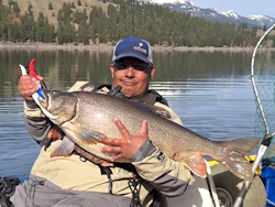
jed with a spring Big Mack
 

Topic: Hitting the water Mon and Tues from Vancouver  (Read 2855 times)

0 Members and 1 Guest are viewing this topic.

BornFree1983

  • Herring
  • **
  • Location: Downtown Vancouver, WA
  • Date Registered: Jun 2012
  • Posts: 22
Early Monday morning I am planning on hitting battleground lake. I am looking for some rainbows. If you know the area I would appreciate any help.

Tuesday I have a bit more time and would like to hit one of the rivers Lewis, Cowlitz or Washougal. Looking for somebody that knows these rivers, If you are free Tues morning Id rather paddle one way with a second boat and vehicle than out and back. Feel free to shoot me any recommendations for some springer spots as well, I am scouting so I can better plan the upcoming months.


Noah

  • Sturgeon
  • *******
  • Cabby Strong!
  • Location: Tigard
  • Date Registered: Mar 2011
  • Posts: 3596
Battle Ground lake is a nice spot. It's not very big so you can work most of the lake within an hour. I've only fished it once but we did pretty well trolling. I think we were just flat lining spinners but a few guys were doing pretty well with a dodger set up too.


BornFree1983

  • Herring
  • **
  • Location: Downtown Vancouver, WA
  • Date Registered: Jun 2012
  • Posts: 22
Thanks Noah! I am looking forward to it.


Widgeonmangh

  • Lingcod
  • *****
  • Fishing Kayaks of Gig Harbor
  • Location: Gig Harbor, WA
  • Date Registered: Jul 2013
  • Posts: 472
Don't live in the area but I would be hitting Merwin if I did. They are doing well on kokanee.
Fish on the right side that's where the fish are! John 21:6

I am no longer a dealer for Wavewalk but if you ever want to paddle one let me know!


m00refish0n

  • Herring
  • **
  • Date Registered: Aug 2013
  • Posts: 26
I work all week dang it, but I'm off the whole following week and looking to fish the lower cowlitz and maybe go out to Willow Grove to troll for springers. It would be nice to finally have another person along so I don't have to beg family members to take me back to the truck at the end of the day.


BornFree1983

  • Herring
  • **
  • Location: Downtown Vancouver, WA
  • Date Registered: Jun 2012
  • Posts: 22
Thanks for the tip on Merwin, I will look into it.

Based on a few things I am going to stick closer to home. I am not finding much info on the Washougal River. Current plan is to hop in and have my wife pick me out of the river at the Sandy swimming hole in Washougal.
River level is predicted to be just below 1000 CFS which we will see what that equates to in river speed out there. I'll post an update.
https://fortress.wa.gov/ecy/wrx/wrx/flows/station.asp?wria=28#block2


BornFree1983

  • Herring
  • **
  • Location: Downtown Vancouver, WA
  • Date Registered: Jun 2012
  • Posts: 22
??? http://levels.wkcc.org/?P=Washington.html
 This other river condition site is predicting 500cfs lower. What gives?


RoxnDox

  • Salmon
  • ******
  • Native Propel
  • Location: Gig Harbor, WA
  • Date Registered: Sep 2013
  • Posts: 677
??? http://levels.wkcc.org/?P=Washington.html
 This other river condition site is predicting 500cfs lower. What gives?

I can't give specifics, since this is a state-run river gage and not one of ours (USGS), and I don't have access to look at all of it.  The wkcc plot looks like it is taking the telemetry values from the NOAA site (NW River Forecast Center) after they have been downloaded and run thru initial validation & processing.  Then the data values for stage (water surface elevation) are run through a mathematical computation called a "rating curve" that derives a flow value in CFS from the stage value.  The rating curve used by wkcc came from the Corps of Engineers, the one from the state may have been a different one (or a different version of a CoE rating).  At some points in the flow regime, a rating curve can be very sensitive to changes in stage and can easily create this sort of difference.

The important thing is that all of these flow numbers are just estimates, based on a mathematical derivation from the observed parameter of stage.  The rating curves basically depend on the shape of hte channel and bed, because that gives the cross sectional area, and also a velocity profile across the whole river (side to side and surface to bed...).  Ratings have to be updated when the channel has significant changes, and they have to be validated periodically by going out to the site and re-measuring the channel and velocities and stage, to make sure the computations are correct.   When you look at those plots and see a little red marker dot on the blue curve, that is a measurement.  As long as it's on the curve you can trust the ratings. 

Jim
Junk Jigs "BEST USE OF ACTUAL JUNK" category - "That tape should have been a prized possession and not junk. That will be a collectors item in 30 years!” & “There sure is a lot of junk in there.”


BornFree1983

  • Herring
  • **
  • Location: Downtown Vancouver, WA
  • Date Registered: Jun 2012
  • Posts: 22
Wow thanks a ton Jim! it will take me reading that a couple times to digest everything you put into it. I really do appreciate your time as learning all these rivers takes some effort


BornFree1983

  • Herring
  • **
  • Location: Downtown Vancouver, WA
  • Date Registered: Jun 2012
  • Posts: 22
Putting in at Washougal river rd mile 3, taking out in Washougal. The water looks good!


RoxnDox

  • Salmon
  • ******
  • Native Propel
  • Location: Gig Harbor, WA
  • Date Registered: Sep 2013
  • Posts: 677
No Problemo...  I figure it's all kind of advertising :)  The state's gaging network is on a map here https://fortress.wa.gov/ecy/wrx/wrx/flows/regions/state.asp, our USGS real-time sites are shown here http://wa.water.usgs.gov/cgi/realtime.data.cgi, and the NOAA regional River Forecast Center has a map at http://www.nwrfc.noaa.gov/rfc/.  The RFC site is nice because it takes data from us, the state, other federal agencies like CoE, BLM, etc, and integrates it into their display (and flood forecast models!).  The more data sources you have, the more likely to find one that is useful.  We don't have a gage on the Washougal any more, but the state keeps theirs active so it's still available...

Jim
Junk Jigs "BEST USE OF ACTUAL JUNK" category - "That tape should have been a prized possession and not junk. That will be a collectors item in 30 years!” & “There sure is a lot of junk in there.”


BornFree1983

  • Herring
  • **
  • Location: Downtown Vancouver, WA
  • Date Registered: Jun 2012
  • Posts: 22
Apart from not catching fish this morning was great! The river was fun, and the weather was perfect! There were lots of holes to be fished.