Welcome, Guest. Please login or register.
May 14, 2025, 02:53:17 AM

Login with username, password and session length

Recent Topics

[May 13, 2025, 07:13:39 PM]

[May 11, 2025, 09:36:38 AM]

[May 08, 2025, 09:53:46 AM]

[May 05, 2025, 09:12:01 AM]

[May 03, 2025, 06:39:16 PM]

by jed
[May 02, 2025, 09:57:11 AM]

[May 01, 2025, 05:53:19 PM]

[April 26, 2025, 04:27:54 PM]

[April 23, 2025, 11:10:07 AM]

by [WR]
[April 23, 2025, 09:15:13 AM]

[April 21, 2025, 10:44:08 AM]

[April 17, 2025, 04:48:17 PM]

[April 17, 2025, 08:45:02 AM]

by jed
[April 11, 2025, 01:03:22 PM]

[April 11, 2025, 06:19:31 AM]

Picture Of The Month


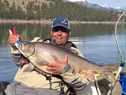
Guess who's back?
jed with a spring Big Mack

Topic: Locating Reef  (Read 1634 times)

0 Members and 1 Guest are viewing this topic.

Zach.Dennis

  • Salmon
  • ******
  • Location: Beaverton, OR
  • Date Registered: Aug 2015
  • Posts: 831
Hello All,

I am wondering if there are any good websites people would recommend for pre-scouting reef locations off the coast?  Or is the only way to find reef is to search for it yourself with the fish finder?  My fishfinder came with a Navionics card.  would it have reefs on the map?

Thanks for helping a newbie!

Zach
2021 1st Place ORC
2023 1st Place ORC


AOGOR

  • Alaska Outdoor Gear -Outfitter and Rentals
  • Herring
  • **
  • Alaska Outdoor Gear -Outfitter and Rental
  • Location: Anchorage, Ak
  • Date Registered: Apr 2016
  • Posts: 39
Hello,

I like using the Navionics maps. I have downloaded the app to my iphone and Ipad. In addition I use the webapp on my computer. I have spent countless hours scouring the maps in search of good structure. All in all it has paid off and I have found some productive fishing holes. I included the link below for the webapp.

http://webapp.navionics.com

Best regards,

Dave
AUTHORIZED DEALER: Vibe Kayaks; Necky Kayaks; Old Town Kayaks ; Malibu Kayaks; Yak Attack; Yak Gear; EGO; Stohlquist

www.alaskaoutdoorgearrental.com
https://www.facebook.com/AlaskaOutdoorGearRental/


Zach.Dennis

  • Salmon
  • ******
  • Location: Beaverton, OR
  • Date Registered: Aug 2015
  • Posts: 831
Just what I was looking for!  Thank you!
2021 1st Place ORC
2023 1st Place ORC


bsteves

  • Fish Nerd
  • Administrator
  • Sturgeon
  • *****
  • Better fishing through science
  • Location: Portland, OR
  • Date Registered: Feb 2007
  • Posts: 4584
I'm sure we could write about book about this topic.

1.) Browsing your Navionics card is a good place to start.  If you want, you can browse Navionics online via there WebApp.   https://webapp.navionics.com

2.) NOAA Charts are a good place to try.  Again, here's an online link.
http://www.nauticalcharts.noaa.gov/mcd/NOAAChartViewer.html

Here's a direct link to the Depoe Bay chart
http://www.charts.noaa.gov/OnLineViewer/18561.shtml

On both the Navionics and NOAA charts... look for "Rk" which are rocky reefs or bathymetry lines with a steep slope

3.) If you have access to some GIS software, here is a link with information on access to data used by NOAA and OSU to identify habitat.

http://efh-catalog.coas.oregonstate.edu/habitat/

Other options..

Google Maps.. satellite

Look for rocky shore, rocky points, and large off shore rocks (i.e. haystacks)   This should give you a feel for where rocky reefs might be found in the water.


Brian
“People say nothing is impossible, but I do nothing every day.”

― A.A. Milne, Winnie-the-Pooh


Zach.Dennis

  • Salmon
  • ******
  • Location: Beaverton, OR
  • Date Registered: Aug 2015
  • Posts: 831
Thanks for the wealth of knowledge Brian!
2021 1st Place ORC
2023 1st Place ORC


RoxnDox

  • Salmon
  • ******
  • Native Propel
  • Location: Gig Harbor, WA
  • Date Registered: Sep 2013
  • Posts: 677
There's also this fun NOAA site

http://maps.ngdc.noaa.gov/viewers/bathymetry/

(toggle off the default "Bathymetric surveys" button, toggle on the "BAG Color Shaded Relief Imagery" button, and zoom in to the area of interest)

If there's a coverage for your target area (say, most of Puget Sound), you'll see nicely detailed seafloor maps.  If not covered, you'll still get good info, just less detail.  And the BAGs only show depths > 5m since that was about the limit of their data collection vessels.  I have used screenshots, printed out and carried with me, as guides since I don't have a FF or GPS unit.

Jim
Junk Jigs "BEST USE OF ACTUAL JUNK" category - "That tape should have been a prized possession and not junk. That will be a collectors item in 30 years!” & “There sure is a lot of junk in there.”