Welcome, Guest. Please login or register.
July 02, 2025, 05:42:33 AM

Login with username, password and session length

Recent Topics

[July 01, 2025, 03:13:39 PM]

[July 01, 2025, 08:55:15 AM]

[July 01, 2025, 06:42:20 AM]

[July 01, 2025, 04:40:08 AM]

[June 28, 2025, 03:25:42 PM]

[June 28, 2025, 07:37:12 AM]

[June 26, 2025, 11:15:57 PM]

[June 25, 2025, 02:09:58 PM]

[June 24, 2025, 02:37:40 AM]

[June 22, 2025, 11:03:48 AM]

[June 13, 2025, 07:00:13 PM]

[June 13, 2025, 02:51:47 PM]

[June 12, 2025, 06:51:40 AM]

[June 06, 2025, 09:02:38 AM]

[June 04, 2025, 11:55:53 AM]

Picture Of The Month


Guess who's back?
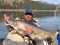
jed with a spring Big Mack

Topic: ORC questions  (Read 39703 times)

0 Members and 1 Guest are viewing this topic.

crash

  • Salmon
  • ******
  • Location: Humboldt, CA and Ashland, OR
  • Date Registered: Jan 2012
  • Posts: 813
BSteves, I'm still in the stone age, or more accurately the paper age, where mapping is concerned, but was able to take a screen shot of the Depoe Bay area of the Navionics map, and mark on it what appear to be the tournament fishing boundaries, based on your aerial photo map.  Did I get the boundaries right?  Someplace in the blizzard of ORC postings was a posting which stated that the southern fishing boundary is Whale Cove, the northern fishing boundary is Rabbit Rock, and the western fishing boundary is 20 fathoms (120 feet).


I'm going to print and laminate this map and your aerial photo boundary map for use on the water.  I have them in a Word document, and can e-mail them to anybody else who would like them.  Send me a message with your e-mail address if you want me to send you the maps.

From the rules thread:

Quote
   n. Observe and remain within the tournament fishing boundaries as follows:
      i. No fishing is allowed in the transit channel between the bell buoy directly west of the harbor entrance and the harbor entrance
      ii. Southern fishing boundary: Cove Point
      iii. Northern fishing boundary: Northernmost edge of the Worldmark Resort buildings
      iv. Western fishing boundary: Water depth of 100 feet

The map you made looks pretty close to correct using the map and locations from the rules.  Just not the landmarks you mention.  Rabbit Rock is way north of the line on your map and whale cove is well south.  The area for competition has been reduced considerably.  Also the depth is 100 feet, not 120.


pmmpete

  • Sturgeon
  • *******
  • Location: Missoula, Montana
  • Date Registered: Jul 2013
  • Posts: 1989
From the rules thread:

Quote
   n. Observe and remain within the tournament fishing boundaries as follows:
      i. No fishing is allowed in the transit channel between the bell buoy directly west of the harbor entrance and the harbor entrance
      ii. Southern fishing boundary: Cove Point
      iii. Northern fishing boundary: Northernmost edge of the Worldmark Resort buildings
      iv. Western fishing boundary: Water depth of 100 feet

The map you made looks pretty close to correct using the map and locations from the rules.  Just not the landmarks you mention.  Rabbit Rock is way north of the line on your map and whale cove is well south.  The area for competition has been reduced considerably.  Also the depth is 100 feet, not 120.
Sorry, I quoted an outdated definition of the tournament area boundaries in my prior e-mail.  Looks like the north boundary is as shown below:


Here’s a revised version of my tournament area map.  Does this look correct?


I have put the aerial photo map of the ORC tournament area and my marked up Navionics map in a Word document, and am going to print it off and laminate it for use on the water.  If anybody wants these maps, send me a personal message with your e-mail address, and I'll e-mail the Word document to you.


bsteves

  • Fish Nerd
  • Administrator
  • Sturgeon
  • *****
  • Better fishing through science
  • Location: Portland, OR
  • Date Registered: Feb 2007
  • Posts: 4584
Yep, that looks pretty good. 
“People say nothing is impossible, but I do nothing every day.”

― A.A. Milne, Winnie-the-Pooh


Dark Tuna

  • Lingcod
  • *****
  • "Dark Tuna?"
  • Location: Redmond / Sammamish, WA
  • Date Registered: Aug 2014
  • Posts: 455
Because I've never fished out of Depoe Bay before, I'm going to go there a couple of days early to get familiar with the area.  Will there be somebody at Chinook Bend from whom we can get a map (preferably a bathymetric map) showing the boundaries of the tournament area, and any other nearby areas where it might be fun to fish?  Could you make such a map available on the internet?


Here are the tournament boundaries..

<snip>

If you have a fish finder / chart plotter with an SD card, I can provide an appropriate file type so that you can load those boundaries.  I'm heading to Alaska for a week, but I should have time to get you a map file.  If you're impatient for me on that...

Attached is the KML file for the following Google Map.  Use that in conjunction with this site to make your own..
http://www.gpsvisualizer.com/gpsbabel/


As for bathymetry...

http://www.charts.noaa.gov/OnLineViewer/18520.shtmlhttp://www.charts.noaa.gov/OnLineViewer/18520.shtml

or the Navionics web app to preview what is on Navionics chips for the area.
https://webapp.navionics.com/?lang=en
Garmin Basecamp accepted your KML file and gives me an Export option.  Save to GPX and attached.   Later today I'll try putting this on my Dragonfly.

(Drop the .txt off the end of the file name to make it a .gpx, which is just an XML file)

2015 Jackson Big Tuna (tandem) (dark forest)
2016 Hobie Outback LE (screamin' orange)
2014 KC Kayaks K12 (the better half's, in camo)
2015 Jackson Kraken 13.5 (bluefin)

Raymarine Dragonfly; BB Angler Aces; Kokatat Hydrus 3L SuperNova Angler Dry Suit; Stohlquist Fisherman PFD


bsteves

  • Fish Nerd
  • Administrator
  • Sturgeon
  • *****
  • Better fishing through science
  • Location: Portland, OR
  • Date Registered: Feb 2007
  • Posts: 4584
https://drive.google.com/open?id=0B7aLjw2IQ-QDek1fRjdJbS11M28

Looks like the forum didn't like my KML attachment.  Here is a link to that KML file.
“People say nothing is impossible, but I do nothing every day.”

― A.A. Milne, Winnie-the-Pooh


bb2fish

  • Sturgeon
  • *******
  • Location: Oregon
  • Date Registered: Feb 2013
  • Posts: 1501
I loaded the GPX map that Dark Tuna converted.  What's the waypoint that's in the SE corner on Land (Unnamed Road SE of Indian Trail Road)?  Is that where the weigh in and check in will be held??


bsteves

  • Fish Nerd
  • Administrator
  • Sturgeon
  • *****
  • Better fishing through science
  • Location: Portland, OR
  • Date Registered: Feb 2007
  • Posts: 4584
I loaded the GPX map that Dark Tuna converted.  What's the waypoint that's in the SE corner on Land (Unnamed Road SE of Indian Trail Road)?  Is that where the weigh in and check in will be held??

That is the tsunami evacuation site.  It was an insurance application  question.
“People say nothing is impossible, but I do nothing every day.”

― A.A. Milne, Winnie-the-Pooh


bb2fish

  • Sturgeon
  • *******
  • Location: Oregon
  • Date Registered: Feb 2013
  • Posts: 1501
I loaded the GPX map that Dark Tuna converted.  What's the waypoint that's in the SE corner on Land (Unnamed Road SE of Indian Trail Road)?  Is that where the weigh in and check in will be held??

That is the tsunami evacuation site.  It was an insurance application  question.
Is that gonna be on the ORC test?   ;D  Hey, at least I'm reading the information your providing, and in case of Tsunami, now everyone knows.
Thanks!


crash

  • Salmon
  • ******
  • Location: Humboldt, CA and Ashland, OR
  • Date Registered: Jan 2012
  • Posts: 813
It was an insurance application  question.

What an extremely odd thing for an underwriter to be concerned about for a single day one off event.


rawkfish

  • Moderator
  • Sturgeon
  • *****
  • Cabby Strong!
  • youtube.com
  • Location: Portland
  • Date Registered: Mar 2009
  • Posts: 4731
It was an insurance application  question.

What an extremely odd thing for an underwriter to be concerned about for a single day one off event.

Any one particular item isn't necessarily a point that an insurance provider is asking for.  It's more about covering every reasonably possible scenario to show that the organizers have a comprehensive grasp of the safety concerns involved with an event.
                
2011 Angler Of The Year
1st Place 2011 PDX Bass Yakin' Classic
"Fishing relaxes me.  It's like yoga except I still get to kill something."  - Ron Swanson


dampainter

  • Salmon
  • ******
  • Location: the dalles, oregon
  • Date Registered: Mar 2013
  • Posts: 731
on the registration page it has a pic of the north boundary about in the middle of the hotel complex( like rules say.....on the north side of the worldmark hotel. on the pic in the above post it shows border on the north side of the thundering shores hotel....just north of the entire hotel complex(worldmark/blue pacific/thundering shores????? which is it? hopefully this is not too much of a burden to get clarification on? does anyone else see the same thing? no answer required for me as i plan to fish south anyway.
« Last Edit: June 21, 2016, 07:33:47 PM by dampainter »


craig

  • Moderator
  • Sturgeon
  • *****
  • Location: Tualatin, OR
  • Date Registered: Jul 2008
  • Posts: 3814
Yes you are correct. There are two slightly different KML files. I did not fill out the insurance application, so I will let bsteves make the change to what it should be according to what was declared.


dampainter

  • Salmon
  • ******
  • Location: the dalles, oregon
  • Date Registered: Mar 2013
  • Posts: 731
no rush for answers, never was/am. that was super quick tho. thx craig!
« Last Edit: June 21, 2016, 07:37:47 PM by dampainter »


craig

  • Moderator
  • Sturgeon
  • *****
  • Location: Tualatin, OR
  • Date Registered: Jul 2008
  • Posts: 3814
You are welcome. 


bsteves

  • Fish Nerd
  • Administrator
  • Sturgeon
  • *****
  • Better fishing through science
  • Location: Portland, OR
  • Date Registered: Feb 2007
  • Posts: 4584
It was an insurance application  question.

What an extremely odd thing for an underwriter to be concerned about for a single day one off event.

Any one particular item isn't necessarily a point that an insurance provider is asking for.  It's more about covering every reasonably possible scenario to show that the organizers have a comprehensive grasp of the safety concerns involved with an event.

The insurance application asked if we had an evacuation plan.  Probably referring to river flood evacuations for white water events.  Depoe Bay has a tsunami evacuation plan and I followed that.
“People say nothing is impossible, but I do nothing every day.”

― A.A. Milne, Winnie-the-Pooh


anything