Welcome, Guest. Please login or register.
May 11, 2025, 05:46:56 PM

Login with username, password and session length

Recent Topics

[Today at 09:36:38 AM]

[May 08, 2025, 09:53:46 AM]

[May 05, 2025, 09:12:01 AM]

[May 03, 2025, 06:39:16 PM]

by jed
[May 02, 2025, 09:57:11 AM]

[May 01, 2025, 05:53:19 PM]

[April 26, 2025, 04:27:54 PM]

[April 23, 2025, 11:10:07 AM]

by [WR]
[April 23, 2025, 09:15:13 AM]

[April 21, 2025, 10:44:08 AM]

[April 17, 2025, 04:48:17 PM]

[April 17, 2025, 08:45:02 AM]

by jed
[April 11, 2025, 01:03:22 PM]

[April 11, 2025, 06:19:31 AM]

[April 07, 2025, 07:03:34 AM]

Picture Of The Month


Guess who's back?
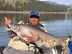
jed with a spring Big Mack

Topic: Simpson Reef Weather/Sea Conditions  (Read 3461 times)

0 Members and 1 Guest are viewing this topic.

DARice

  • Rockfish
  • ****
  • Location: Portland
  • Date Registered: Aug 2014
  • Posts: 178
I'll be camping at Sunset Bay State Park this coming weekend and am hoping for good 'yak fishing conditions. What's the best source for sea state/wind for that area?

Also, while I did some spear fishing and shore fishing there a couple of (gulp) decades ago, is the preferred/only launch spot through Sunset Bay?

Thanks!
Dave


Matt M

  • Sturgeon
  • *******
  • Location: Tigard
  • Date Registered: Mar 2016
  • Posts: 1266
I think Coos Bay is probably the closest surf report you will find (someone could easily prove me wrong.) The conditions look to be quite sporty with Sunday looking the better of the two days but still pretty windy... Things could certainly change in the next few days.

http://magicseaweed.com/Coos-Bay-Surf-Report/320/
-Matt

Old Town Sportsman 120 PDL


bb2fish

  • Sturgeon
  • *******
  • Location: Oregon
  • Date Registered: Feb 2013
  • Posts: 1501
I use NOAA Marine Point Forecasts and select the exact coordinates for where you'll be fishing.  The summary description provides surrounding marine conditions, and not just the "surf report" from magic seaweed.  Stormsurf is another weather tool for longer range conditions.


rogerdodger

  • Fish Retriever
  • Sturgeon
  • *******
  • roger
  • Location: Florence OR
  • Date Registered: Dec 2012
  • Posts: 1578
I use NOAA Marine Point Forecasts and select the exact coordinates for where you'll be fishing.  The summary description provides surrounding marine conditions, and not just the "surf report" from magic seaweed.  Stormsurf is another weather tool for longer range conditions.

I like the Magic Seaweed better than the NOAA forecasts because it gives ocean swell (primary and secondary with direction) and wind predictions for 3 hour time windows, I ignore the surf part since that isn't a factor in launching out of Sunset Bay.    I always use the Coos Bay forecast from MagicSeaWeed for my Sunset Bay trips.  cheers, roger
2019 Hobie Outback (Fish Retriever)


DARice

  • Rockfish
  • ****
  • Location: Portland
  • Date Registered: Aug 2014
  • Posts: 178
Thanks for the replies! Unfortunately, Friday evening and Saturday are the two days I have to hit the salt...looking a bit too bumpy right now.

Dave


rogerdodger

  • Fish Retriever
  • Sturgeon
  • *******
  • roger
  • Location: Florence OR
  • Date Registered: Dec 2012
  • Posts: 1578
Thanks for the replies! Unfortunately, Friday evening and Saturday are the two days I have to hit the salt...looking a bit too bumpy right now.

Dave

I agree, Thursday, unfortunately, is the day that looks good. 
2019 Hobie Outback (Fish Retriever)


Tinker

  • Sturgeon
  • *******
  • Kevin
  • Location: 42.74°N 124.5°W
  • Date Registered: May 2013
  • Posts: 3338
Magicseaweed is never accurate enough about wind speed and direction forecasts for planning trips that require a long drive to the Coos Bay area.

Windyty is very close to spot on with wind speed and direction close to shore.

Use them both, but trust the wind forecasts from Windyty.
The fish bite twice a day - just before we get here and right after we leave.


rogerdodger

  • Fish Retriever
  • Sturgeon
  • *******
  • roger
  • Location: Florence OR
  • Date Registered: Dec 2012
  • Posts: 1578
Magicseaweed is never accurate enough about wind speed and direction forecasts for planning trips that require a long drive to the Coos Bay area.

Windyty is very close to spot on with wind speed and direction close to shore.

Use them both, but trust the wind forecasts from Windyty.

I have limited data but the 5 times that I have been out of Sunset Bay in 2016, the MSW wind and swell predictions have been right on....I will add the Windyty to my sources and see how it compares...
2019 Hobie Outback (Fish Retriever)


Captain Redbeard

  • Lauren
  • Global Moderator
  • Sturgeon
  • *****
  • Location: Portland, OR
  • Date Registered: May 2013
  • Posts: 3327
I had someone tell me MagicSeaweed isn't good for wind too, but every time I go out to Pacific City it's pretty darn close to reality. I try to average a couple of good sites, but overall MS seems to understand what I'm looking for.


Tinker

  • Sturgeon
  • *******
  • Kevin
  • Location: 42.74°N 124.5°W
  • Date Registered: May 2013
  • Posts: 3338
I did say Sunset Bay, didn't I?  If not, let me correct that: MSW does predictions based on the conditions at the Coos Bay/North Bend Airport and the wind speed/direction forecasts don't necessarily apply to conditions southwest of the airport.

Windfinder is a more accurate site that I use for local conditions, but they don't give information about waves and swells for Coos Bay.

But all of them, including NOAA, missed the thunderstorms that are rolling through this morning.  A pox upon all their houses!
The fish bite twice a day - just before we get here and right after we leave.


crash

  • Salmon
  • ******
  • Location: Humboldt, CA and Ashland, OR
  • Date Registered: Jan 2012
  • Posts: 813
MSW is completely unreliable for wind in Brookings.  It's been pretty good most other places I've used it.  But not Brookings.  MSW usually wildly overstates the wind there.


rogerdodger

  • Fish Retriever
  • Sturgeon
  • *******
  • roger
  • Location: Florence OR
  • Date Registered: Dec 2012
  • Posts: 1578
I did say Sunset Bay, didn't I?  If not, let me correct that: MSW does predictions based on the conditions at the Coos Bay/North Bend Airport and the wind speed/direction forecasts don't necessarily apply to conditions southwest of the airport.

can you point to where you found that info?   it is not logical for them to give a surf forecast based on wind at an inland location. 
here is the screenshot from MSW showing the Coos Bay spot guide surf forecast, looks like just off Bastendorff beach..


I fish near the NB Airport quite a lot and the NOAA wind forecast for that location is usually pretty good (it's an airport), the MSW 'CoosBay' wind does not match what I find near the airport, it has matched what I have found off Sunset Bay and in the lower bay near the jaws.
2019 Hobie Outback (Fish Retriever)


Tinker

  • Sturgeon
  • *******
  • Kevin
  • Location: 42.74°N 124.5°W
  • Date Registered: May 2013
  • Posts: 3338
There isn't an anemometer at Sunset Bay or Cape Arago.  The airport has the only anemometer in the area unless some MSW employee is driving down to the Park with one.  It's good that you find MSW a reliable source for information about Sunset Bay.  I don't.  I've been at Sunset when MSW says the winds are 7 knots but they're really much stronger - I don't own an anemometer and I don't suggest I know how much stronger they were, but crap was blowing all over the place all morning.  Maybe they had a bad day, but I stopped trusting their Coos Bay forecasts and looked elsewhere.

I agree 100% with crash that MSW is less accurate in some areas than in others.  I suppose it depends on where they get the base data for their forecasts.
« Last Edit: September 22, 2016, 02:43:32 PM by Tinker »
The fish bite twice a day - just before we get here and right after we leave.


smilinkayaker

  • Lingcod
  • *****
  • Date Registered: Sep 2014
  • Posts: 223
From last Thursday to Sunday magic seaweed was spot on at sunset, by the coos bay option....and after being there even if you didn't go to Simpson reef, the fishing is good just outside the bay as well!


rogerdodger

  • Fish Retriever
  • Sturgeon
  • *******
  • roger
  • Location: Florence OR
  • Date Registered: Dec 2012
  • Posts: 1578
There isn't an anemometer at Sunset Bay or Cape Arago.  The airport has the only anemometer in the area unless some MSW employee is driving down to the Park with one.  It's good that you find MSW a reliable source for information about Sunset Bay.  I don't.  I've been at Sunset when MSW says the winds are 7 knots but they're really much stronger - I don't own an anemometer and I don't suggest I know how much stronger they were, but crap was blowing all over the place all morning.  Maybe they had a bad day, but I stopped trusting their Coos Bay forecasts and looked elsewhere.

I agree 100% with crash that MSW is less accurate in some areas than in others.  I suppose it depends on where they get the base data for their forecasts.

8am Friday:

NOAA NB airport:  7mph SSE
MSW CoosBay (off Bastendorff):  19mph 171 degrees
Windyty off Bastendorff: 10kt (11.5mph) 160 degrees

FYI-  NOAA has a 'data bouy' with anemometer near the mouth of Coos Bay, based on location digits, it is at CoosHead near the CG tower.

http://www.ndbc.noaa.gov/station_page.php?station=chao3


« Last Edit: September 23, 2016, 08:51:46 AM by rogerdodger »
2019 Hobie Outback (Fish Retriever)


anything