Welcome, Guest. Please login or register.
June 30, 2025, 11:08:24 PM

Login with username, password and session length

Recent Topics

[Today at 10:52:27 PM]

[June 28, 2025, 03:25:42 PM]

[June 28, 2025, 07:37:12 AM]

[June 28, 2025, 05:42:03 AM]

by jed
[June 27, 2025, 08:40:38 PM]

[June 26, 2025, 11:15:57 PM]

[June 25, 2025, 02:09:58 PM]

[June 24, 2025, 02:37:40 AM]

[June 22, 2025, 11:03:48 AM]

[June 13, 2025, 07:00:13 PM]

[June 13, 2025, 02:51:47 PM]

[June 12, 2025, 06:51:40 AM]

[June 06, 2025, 09:02:38 AM]

[June 04, 2025, 11:55:53 AM]

[June 03, 2025, 06:11:22 PM]

Picture Of The Month


Guess who's back?
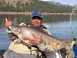
jed with a spring Big Mack

Topic: Pacific City 2009 ???  (Read 22933 times)

0 Members and 1 Guest are viewing this topic.

bsteves

  • Fish Nerd
  • Administrator
  • Sturgeon
  • *****
  • Better fishing through science
  • Location: Portland, OR
  • Date Registered: Feb 2007
  • Posts: 4584
I seem to have gotten off track a bit so I moved the bit about scheduling monthly events to a new thread.

http://www.northwestkayakanglers.com/index.php/topic,1862.msg15567/topicseen.html#new
“People say nothing is impossible, but I do nothing every day.”

― A.A. Milne, Winnie-the-Pooh


[WR]

  • Sturgeon
  • *******
  • VFW, Life Member at Large, since 1997.
  • Location: currently 17870
  • Date Registered: Jan 2008
  • Posts: 4753


pole, where did you get your charts for that area?? i'd like to take a look at what we were sittin over when we were "out there"


Here's the noaa chart:

http://sailvector.com/1735/Yaquina-Head-to-Columbia-R

roy,
thanx for the link. interesting but i'd like to have something larger and unconfined that i could download and print.. on a larger scale too..... anyone have somehting like that they'd want to share??
rich


bsteves

  • Fish Nerd
  • Administrator
  • Sturgeon
  • *****
  • Better fishing through science
  • Location: Portland, OR
  • Date Registered: Feb 2007
  • Posts: 4584
I think there's actually a better chart for the area, I don't remember the number.  If I can find it, you should be able to view it online in a similar viewer as well as order an actual copy of the actual NOAA chart for a small fee.

Brian
“People say nothing is impossible, but I do nothing every day.”

― A.A. Milne, Winnie-the-Pooh


steelheadr

  • Participant in life...not spectator
  • Sturgeon
  • *******
  • Pay no attention to the man in the hat.
  • Peterberger Adventures
  • Location: obviously not fishing...
  • Date Registered: Jul 2007
  • Posts: 1865
I picked up some Dramamine today and dropped it into my tackle box. I'm ready for 2009 now... ;D
"Fast enough to get there...but slow enough to see. Not known for predictability"  Thanks to Jimmy Buffet for describing my life...again


bsteves

  • Fish Nerd
  • Administrator
  • Sturgeon
  • *****
  • Better fishing through science
  • Location: Portland, OR
  • Date Registered: Feb 2007
  • Posts: 4584
I picked up some Dramamine today and dropped it into my tackle box. I'm ready for 2009 now... ;D

You might want to check the shelf life on the Dramamine.  It might be a good idea to get some fresh stuff next September.
“People say nothing is impossible, but I do nothing every day.”

― A.A. Milne, Winnie-the-Pooh


steelheadr

  • Participant in life...not spectator
  • Sturgeon
  • *******
  • Pay no attention to the man in the hat.
  • Peterberger Adventures
  • Location: obviously not fishing...
  • Date Registered: Jul 2007
  • Posts: 1865
It's good until 2011 but I hope to be using it quite a bit before that
"Fast enough to get there...but slow enough to see. Not known for predictability"  Thanks to Jimmy Buffet for describing my life...again


[WR]

  • Sturgeon
  • *******
  • VFW, Life Member at Large, since 1997.
  • Location: currently 17870
  • Date Registered: Jan 2008
  • Posts: 4753
I think there's actually a better chart for the area, I don't remember the number.  If I can find it, you should be able to view it online in a similar viewer as well as order an actual copy of the actual NOAA chart for a small fee.

Brian

thanx B.. :-[ i later went on a web search, and yep, you're right, there are a lot of larger ones out there. some not too bad in cost but a lot that are pricey.. and i found one that i lost and really liked, so i have to go back and find it, but it gives you really good detail in color, and you can download and print it for under $10.00 ???

now all i need is a desktop plotter, waterproof inks and paper and i'm in business. :'(


polepole

  • Administrator
  • Sturgeon
  • *****
  • NorthWest Kayak Anglers
  • Location: San Jose, CA :(
  • Date Registered: Apr 2006
  • Posts: 10099
I think there's actually a better chart for the area, I don't remember the number.  If I can find it, you should be able to view it online in a similar viewer as well as order an actual copy of the actual NOAA chart for a small fee.

Brian

I wasn't able to find a better map of that section.   :(  Please do share if you know of one!!!   ;)

-Allen


Spot

  • Administrator
  • Sturgeon
  • *****
  • Cabby Strong!
  • Location: Hillsboro
  • Date Registered: Jul 2007
  • Posts: 5959
I picked up some Dramamine today and dropped it into my tackle box. I'm ready for 2009 now... ;D

Keep an eye on the ocean Jay.  There will be more opportunities to fish the ocean before next summer.  Fall and Winter occasionally serve up some dead flat days and when they do, you don't have to worry about the afternoon winds.  A couple of the glassiest days I've ever seen had a backdrop of snow in the coast range.
Twenty years from now you will be more disappointed by the things you didn't do than by the ones you did do. So throw off the bowlines. Sail away from the safe harbor. Catch the trade winds in your sails. Explore. Dream. Discover.  --Mark Twain

Sponsors and Supporters:
Team Daiwa        Next Adventure       Kokatat Immersion Gear

Tournament Results:
2008 AOTY 1st   2008 ORC 1st  2009 AOTY 1st  2009 NA Sturgeon Derby 1st  2012 Salmon Slayride 3rd  2013 ORC 3rd  2013 NA Sturgeon Derby 2nd  2016 NA Chinook Showdown 3rd  2020 BCS 2nd   2022 BCS 1st


steelheadr

  • Participant in life...not spectator
  • Sturgeon
  • *******
  • Pay no attention to the man in the hat.
  • Peterberger Adventures
  • Location: obviously not fishing...
  • Date Registered: Jul 2007
  • Posts: 1865
I picked up some Dramamine today and dropped it into my tackle box. I'm ready for 2009 now... ;D

Keep an eye on the ocean Jay.  There will be more opportunities to fish the ocean before next summer.  Fall and Winter occasionally serve up some dead flat days and when they do, you don't have to worry about the afternoon winds.  A couple of the glassiest days I've ever seen had a backdrop of snow in the coast range.

Ever since my chumming episode, I've been keeping an eye on the forecast. I figure on one fishing day each weekend (hopefully) so a hopeful forecast will generate a shout out to the group... ;D  It's time for the fish to feed me!!!
"Fast enough to get there...but slow enough to see. Not known for predictability"  Thanks to Jimmy Buffet for describing my life...again


[WR]

  • Sturgeon
  • *******
  • VFW, Life Member at Large, since 1997.
  • Location: currently 17870
  • Date Registered: Jan 2008
  • Posts: 4753
I think there's actually a better chart for the area, I don't remember the number.  If I can find it, you should be able to view it online in a similar viewer as well as order an actual copy of the actual NOAA chart for a small fee.

Brian

I wasn't able to find a better map of that section.   :(  Please do share if you know of one!!!   ;)

-Allen

soon as i re-find it, i'll share.


[WR]

  • Sturgeon
  • *******
  • VFW, Life Member at Large, since 1997.
  • Location: currently 17870
  • Date Registered: Jan 2008
  • Posts: 4753
ok, told ya i'd share. this is the one i found that i liked.. it still isnt the worlds best, but then we gotta remember what we're dealing with.

like FFTW on the other thread regarding charts, i'd like to have tons more detail too.. maybe we're not looking for the right type or set of charts?

anyways;
http://www.oceangrafix.com/o.g/Charts/chartViewer.html?viewRegion=Pacific&viewChart=Cape-Blanco-to-Cape-Flattery

ok just checked online at the USC.edu site and via google searching thru the Naval academy online library. what we need are called submarine topography charts. far more detailed than the standard nav charts we ususally use. finding them might be another matter entirely tho. anyone want to help me find a source?


« Last Edit: October 04, 2008, 09:36:51 PM by wanderingrichard »


Alkasazi

  • Lingcod
  • *****
  • Alkasazi
  • Location: Columbia Gorge
  • Date Registered: Oct 2007
  • Posts: 485
« Last Edit: October 05, 2008, 12:01:20 AM by Alkasazi »


bsteves

  • Fish Nerd
  • Administrator
  • Sturgeon
  • *****
  • Better fishing through science
  • Location: Portland, OR
  • Date Registered: Feb 2007
  • Posts: 4584
Pisco Sicko posted this link awhile back..

Map link
“People say nothing is impossible, but I do nothing every day.”

― A.A. Milne, Winnie-the-Pooh


[WR]

  • Sturgeon
  • *******
  • VFW, Life Member at Large, since 1997.
  • Location: currently 17870
  • Date Registered: Jan 2008
  • Posts: 4753
wow, lots of info out there isn't there?

guys, pardon my many times over enthusiastic desire to help and share,  but may i suggest [ ammended] we add these links to our WIKI under a heading of " online maps"?
« Last Edit: October 05, 2008, 11:44:04 AM by wanderingrichard »


anything