Welcome, Guest. Please login or register.
July 02, 2025, 06:21:00 PM

Login with username, password and session length

Recent Topics

[Today at 02:20:49 PM]

[July 01, 2025, 03:13:39 PM]

[July 01, 2025, 08:55:15 AM]

[July 01, 2025, 06:42:20 AM]

[July 01, 2025, 04:40:08 AM]

[June 28, 2025, 03:25:42 PM]

[June 26, 2025, 11:15:57 PM]

[June 25, 2025, 02:09:58 PM]

[June 24, 2025, 02:37:40 AM]

[June 22, 2025, 11:03:48 AM]

[June 13, 2025, 07:00:13 PM]

[June 13, 2025, 02:51:47 PM]

[June 12, 2025, 06:51:40 AM]

[June 06, 2025, 09:02:38 AM]

[June 04, 2025, 11:55:53 AM]

Picture Of The Month


Guess who's back?
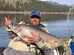
jed with a spring Big Mack
 

Topic: Seahurst Park  (Read 5102 times)

0 Members and 1 Guest are viewing this topic.

aug_aug

  • Plankton
  • *
  • Location: Shoreline, WA
  • Date Registered: Aug 2006
  • Posts: 6
Does anyone have any advice for fishing in the Seahurst Park area, near Burien, WA? My in-laws live pretty close and I am often down there on the weekends. It looks pretty easy to launch and from what I've read the currents are pretty tame.

I'm just wondering where to paddle once I get going and what to fish for. So, if anybody's got any advice I'd love to hear it.

Thanks.
 ::)


polepole

  • Administrator
  • Sturgeon
  • *****
  • NorthWest Kayak Anglers
  • Location: San Jose, CA :(
  • Date Registered: Apr 2006
  • Posts: 10099
Three Tree Point is just to the south of there and is a decent spot for salmon.

-Allen


aug_aug

  • Plankton
  • *
  • Location: Shoreline, WA
  • Date Registered: Aug 2006
  • Posts: 6
How far south? Do you mean paddling south from Seahurst? I was also wondering about a good source for maps, like depth charts or something for the area, any ideas?


polepole

  • Administrator
  • Sturgeon
  • *****
  • NorthWest Kayak Anglers
  • Location: San Jose, CA :(
  • Date Registered: Apr 2006
  • Posts: 10099
Perhaps 2 miles paddling south.  On an outgo tide you don't even need to make your way all the way to the point.  You can fish the rips that form off it.

Here's an online nautical chart of the area.  You can zoom in and out on this map.  I believe north is to the left on this link.

http://mapserver.maptech.com/homepage/index.cfm?lat=47.46009615987498&lon=-122.37085003583769&scale=80000&zoom=100&type=0&icon=0&searchscope=dom&CFID=20913404&CFTOKEN=94185637&scriptfile=http://mapserver.maptech.com/homepage/index.cfm&latlontype=DMS

-Allen


aug_aug

  • Plankton
  • *
  • Location: Shoreline, WA
  • Date Registered: Aug 2006
  • Posts: 6
Awesome, thanks! So fish the rips off the point? Got any tackle suggestions? I have the usual collection of spoons, but I have the plastic diving thing for trolling too, just not sure what to use.