Welcome, Guest. Please login or register.
May 04, 2025, 04:47:58 AM

Login with username, password and session length

Recent Topics

[May 03, 2025, 06:39:16 PM]

[May 03, 2025, 05:50:52 PM]

by jed
[May 02, 2025, 09:57:11 AM]

[May 01, 2025, 05:53:19 PM]

[April 26, 2025, 04:27:54 PM]

[April 23, 2025, 11:10:07 AM]

by [WR]
[April 23, 2025, 09:15:13 AM]

[April 21, 2025, 10:44:08 AM]

[April 17, 2025, 04:48:17 PM]

[April 17, 2025, 08:45:02 AM]

by jed
[April 11, 2025, 01:03:22 PM]

[April 11, 2025, 06:19:31 AM]

[April 07, 2025, 07:03:34 AM]

[April 05, 2025, 08:50:20 PM]

[March 31, 2025, 06:17:42 PM]

Picture Of The Month


Guess who's back?
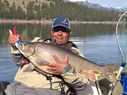
jed with a spring Big Mack

Topic: Kayaking Fog and current  (Read 25252 times)

0 Members and 2 Guests are viewing this topic.

rawkfish

  • ORC
  • Sturgeon
  • *
  • Cabby Strong!
  • youtube.com
  • Location: Portland
  • Date Registered: Mar 2009
  • Posts: 4731
This is an important point: when it comes to a GPS unit, the direction it gives you is the net direction your kayak is moving or course made good, not the direction you think you should be heading in.  There are GPS units that have an electronic compass which will actually orient to the direction the unit is pointed.  This requires a calibration process for this functionality work properly.  I've had a unit with electronic compass and honestly, I didn't like it.  Like Lee said, the unit is useless if you don't know how to use it.
« Last Edit: June 17, 2012, 09:05:23 PM by rawkfish »
                
2011 Angler Of The Year
1st Place 2011 PDX Bass Yakin' Classic
"Fishing relaxes me.  It's like yoga except I still get to kill something."  - Ron Swanson


h_chris_e

  • Perch
  • ***
  • Location: Tacoma Wa
  • Date Registered: Jul 2010
  • Posts: 78
Its good to hear you made it back safe.  I had noticed you coming in on the CG boat and wondered what happened. 

After my own experience that day and hearing your story I learned a couple things.

First is trying to navigate in fog with our slow kayaks GPS is not as helpful as one would think.  The response time of the GPS showing you the direction your heading is to slow.  Without line of sight it is sometime hard to tell if you going straight causing you to over correct and zig zag to much against a current that you have to go straight into.

Second is I will not be going out in the ocean again without a compass.  GPS is a great tool but by no means is it the final solution to proper navigation.  I had my first ocean huli Saturday and my brand new Mark 4 DSI crapped out luckily I was not far from the bell buoy and navigated of that back in safely.  If I had a compass with me I would not of had to worry so much just head east then (north or south) depending on your initial compass reading you take when you go out.

I almost wonder if a compass should be mandatory along with proper immersion gear and flag.


The Nothing

  • De nihilo nihil
  • Sturgeon
  • *******
  • De nihilo nihil
  • YakFish@IOL
  • Location: NE PDX
  • Date Registered: May 2009
  • Posts: 1132
The mistake I made was turning off my radio.

I was back on land, but I also thought your GPS was map-enabled, not just co-ords. There was a group of divers at DB that had to cancel their trip because of current. They were willing to give chase. As I mentioned earlier, I had assumed you were also moving in the right direction.

GPS is great to have, but it's nothing without a map. Be it an actual paper map (waterproof, naturally) or electronic. A compass is also necessary, be it magnetic or electronic. I know I'm also thinking of yet another redundancy in my setup with a magnetic compass.


My first time in the salt was in Depoe, with even worse fog than we experienced this weekend. I was NOT dressed for immersion. I did NOT have a radio. My cellphone was next to useless and I had NO REASON to be on the water. I went out at it was a great day to be on the water. Nice and sunny, the swell was low, just awesome. I knew that I didn't know what I was doing so I kept it inside the North Reef. When I got through the hole, I saw the fog off in the distance. I kept my eye on it, but I didn't think it was going to get close. That's what the sun is for, right, to burn off the fog? The moment I turned my back was when the fog rolled in. I knew there was another boat on the inside with me that had a couple crab traps out. Once the fog rolled in I could barely even see the bow of my T15. All I could do was tread water and wait. I, like you, decided just to keep in earshot of the first bell buoy--that was the best I could do. So long as I kept the bell on my right side, I knew I'd be in decent shape. The boat also had a bell so I had a good idea of where it was at too. We never got close to each other, but I know I was afraid that I'd get ran over. I didn't have a radio. I didn't have a flag. I didn't have a light. Again, I had NO REASON to be out there. At one point I found myself nearly vertical. The bow of my kayak was in the water and I found myself surfing on the North Reef. With my time on the water countable by hours, I was definitely in over my head.

The conditions on Saturday were VERY reminiscent of my first trip described above.

Kayaking in the salt is something to take very seriously. I learned that day that there was a huge checklist of things I needed to have before I even tried to hit the coast again. That checklist was also all the things people here have mentioned through the years: maps, compass, VHF radio, GPS, immersion gear, etc. It can and will look like the perfect day to be on the water. It can and will change in a moment. All you have to do is turn your back.
~Isaac
Blog 'YakFish
ProStaff NRSJackson Kayak | PK Lures | YakAngler


willbd

  • Lingcod
  • *****
  • Location: Woodburn Oregon
  • Date Registered: Jul 2011
  • Posts: 317
The mistake I made was turning off my radio.

I was back on land, but I also thought your GPS was map-enabled, not just co-ords. There was a group of divers at DB that had to cancel their trip because of current. They were willing to give chase. As I mentioned earlier, I had assumed you were also moving in the right direction.

My fish finder has mapping and my radio has GPS also. I knew where I was. I just could not move against the current.

willbd


Pelagic

  • Sturgeon
  • *******
  • Location: Oregon City & Netarts
  • Date Registered: Aug 2008
  • Posts: 2469
When using a gps... wouldn't you just determine the direction of the current... then the direction you want to go from the gps... orient your yak that direction, taking into consideration the current, and continue to paddle/pedal... while continuing to keep an eye on the birds eye view on the gps?  At least this is what I have run through in my head and I am now curious if I have that correctly understood.

The GPS shows speed and direction. I had a speed of 0.9 mph pedaling into the current.  I was facing north but i was moving south while pedaling.

If your gps is similar to mine that should mean that you were making .9 mph headway (speed over ground) to the north (sun on the right) .  Zee and I made similar and very slow headway when resetting our drifts off whale cove.  If you had kept grinding away at that speed you would have hit Depoe in +- 3hours plus perhaps sooner (the current slacked off considerably about midday).  However its hard to know that when you are alone lost in the fog.  Glad your safe and it all worked out well.


willbd

  • Lingcod
  • *****
  • Location: Woodburn Oregon
  • Date Registered: Jul 2011
  • Posts: 317
When using a gps... wouldn't you just determine the direction of the current... then the direction you want to go from the gps... orient your yak that direction, taking into consideration the current, and continue to paddle/pedal... while continuing to keep an eye on the birds eye view on the gps?  At least this is what I have run through in my head and I am now curious if I have that correctly understood.

The GPS shows speed and direction. I had a speed of 0.9 mph pedaling into the current.  I was facing north but i was moving south while pedaling.

Correct. But Rawkfish told me to head east into the sun. With the current moving to the south it made me drift south at 3 mph.
I was at N 44 47.380  w 124 06.297 when I started to head into the sun. The Coast Guard picked me up at N 44 45.735 W 124 04.800.

willbd


If your gps is similar to mine that should mean that you were making .9 mph headway (speed over ground) to the north (sun on the right) .  Zee and I made similar and very slow headway when resetting our drifts off whale cove.  If you had kept grinding away at that speed you would have hit Depoe in +- 3hours plus perhaps sooner (the current slacked off considerably about midday).  However its hard to know that when you are alone lost in the fog.  Glad your safe and it all worked out well.


rawkfish

  • ORC
  • Sturgeon
  • *
  • Cabby Strong!
  • youtube.com
  • Location: Portland
  • Date Registered: Mar 2009
  • Posts: 4731
Correct. But Rawkfish told me to head east into the sun. With the current moving to the south it made me drift south at 3 mph.
I was at N 44 47.380  w 124 06.297 when I started to head into the sun. The Coast Guard picked me up at N 44 45.735 W 124 04.800.

willbd

Right, because the quickest way for you to get back to Depoe Bay under your own power would have been to cut across the current and head toward shore.  As Pelagic pointed out, it would have taken you all day to get back to the hole if you fought the current.  Sure, you ended up quite a bit farther south, but the current was much more manageable inside of a quarter mile of shore and you would have been in the company of more kayak fishermen and power boaters at that point so if you needed a hand quickly, there would be plenty of people near you. 
                
2011 Angler Of The Year
1st Place 2011 PDX Bass Yakin' Classic
"Fishing relaxes me.  It's like yoga except I still get to kill something."  - Ron Swanson


IslandHoppa

  • iHoppa
  • Sturgeon
  • *******
  • Location: Camas, WA
  • Date Registered: May 2011
  • Posts: 1914
When I heard his distress call Brian sounded tired and weak. He didn't seem panicked but since I had just started fishing and was at the buoy I thought I was closer to him than anyone else.

My thought was I could reach Brian faster sailing downwind with the current (I was clocking over 8 mph) and he could sit in the rear seat on my TI and we could tow his yak back.

The gps coordinates he gave out were way north of his actual location. I had sailed about 4-5 miles south of the buoy when he called out 44 deg 47 min N. and slightly west of my location.

At that point I was about 2 miles offshore with no sight nor sound of land. I began heading north at that point and he kept repeating coordinates indicating he was north of me and moving southeast.

When the Coast Guard passed me on their way to reach him they said he was about 1/2 mile south of me. I continued tacking and peddling my way home.

Between the south current and north wind it was a long return trip. Not sure when I started south but didn't get back to DB until 3  PM. My FlyToMap GPS app on my iPhone was a real life saver. It's the only way I could be sure where I was and whet my course and speed were. I'll post my track later.

Sad part of this is we both had Standard Horizon HX851 radios with GPS and registered with MMSI but I didn't know how to use the features that would have allowed us to track each other. I'm pretty tech savvy but the unit is not intuitive at all so I'll now be putting In the time to become proficient in its use before getting back on the water.

I did enjoy getting to sail the salt but the TI is not an efficient vessel into a light wind against a strong current. Fog does raise the stress level substantially and diminish the joy of open water cruising. I covered about 15-18 miles overall even though I was never more than about 5-7 miles from DB.

Thanks for the burger and brew, Brian. It was great to get to know you better and I look forward to meeting again in less adventurous circumstances!


Sent from my iPhone using Tapatalk
iHop

"Of all the things that wisdom provides to help one live one's entire life in happiness, the greatest by far is the possession of friendship." Epicurus

Hobie Tandem Island. OK Tetra 12, Jackson Coosa


INSAYN

  • ORC_Safety
  • Sturgeon
  • *
  • **RIP...Ron, Ro, AMB, Stephen**
  • Location: Forest Grove, OR
  • Date Registered: Aug 2008
  • Posts: 5417
IHOPP there is a feature that even I have not tried yet on the Standard Horizon HX851, and it might be what you are referring to.

If you and Willdb punched in each other's DSC numbers you could then use the VHF to see how far he was from you, and in what direction. 

I haven't had anyone around with their DSC VHF on, or programmed before this trip to practice. 
Will work on it soon at Hagg Lake. 
 

"If I was ever stranded on a beach with only hand lotion...You're the guy I'd want with me!"   Polyangler, 2/27/15


IslandHoppa

  • iHoppa
  • Sturgeon
  • *******
  • Location: Camas, WA
  • Date Registered: May 2011
  • Posts: 1914
I know the feature is there, just need to learn and practice it. NWKA should have an "Instrument Rating" school where we all have to wear blinders and just look at our VHF/GPS and try to find each other or a fixed reference point. Maybe we could do it on land or a "no power boat" lake.


iHop

"Of all the things that wisdom provides to help one live one's entire life in happiness, the greatest by far is the possession of friendship." Epicurus

Hobie Tandem Island. OK Tetra 12, Jackson Coosa


IslandHoppa

  • iHoppa
  • Sturgeon
  • *******
  • Location: Camas, WA
  • Date Registered: May 2011
  • Posts: 1914
Holy Crap!! If the iPhone was as miserable to operate as the HX851 Steve Jobs would have died a pauper!

I've just plowed through the first 48 of 108 pages of the owners manual. Considering this is a device designed to be used to save lives in highly stressful situations it amazes me that it's so incredibly cumbersome to do anything with it. I can only assume that the number of potential users is too small for anyone to create a truly user friendly VHF with DSC.

I can hardly imagine anyone who is seriously injured or being tossed around in a major storm being able to plow through the zillion steps to communicate. Luckily you can just push and hold the DSC emergency button without designating the nature of the emergency and if you're close enough for someone to pick up the signal they should receive your GPS coordinates and be able to send help.

In Brian's case he wasn't in serious trouble but I guess being lost, having zero visibility and being unable to return under your own power still qualifies for hitting the Distress Button.

Here's my Track on Google Earth, I didn't start the track till well after I'd headed back north.

It's nearly 1 AM and I'm bagging it for the night but tomorrow I'll read the other 60 pages and then start keying in all the MMSIs for my NWKA pals. That should only take a week or so. Then we need to get out there and practice it.
iHop

"Of all the things that wisdom provides to help one live one's entire life in happiness, the greatest by far is the possession of friendship." Epicurus

Hobie Tandem Island. OK Tetra 12, Jackson Coosa


Fungunnin

  • Sturgeon
  • *******
  • Date Registered: Aug 2010
  • Posts: 2548
The biggest component of fishing in the salt is being aware and prepared to handle the conditions as  they develop once you are on the water.
Immersion gear, VHF, and GPS are great but you need to be physically able to grind against a 2+ mph current for at least 2-3 hours if need be.
In the Straights of Juan De Fuca we get that kind of current all the time and it will ruin your day fast. Kayak fishing is not easy and we have to be physically prepared to battle the elements. Going out for a little paddle can quickly turn into serious situation if you are not aware.
I am glad everyone is safe and uninjured after this whole ordeal, but the point that sticks out to me is that you would have to drift for over and hour to end up that far south and if you are slowing your drift to 0.9 mph you would have had 3+ hours to get that far. If this had happened 1 mile from port this would have been very different.


Noah

  • Sturgeon
  • *******
  • Cabby Strong!
  • Location: Tigard
  • Date Registered: Mar 2011
  • Posts: 3596
Brian, glad you made it back to shore okay. The conditions were challenging and early in the morning it was hard to determine what direction you were going in the thick fog. I had problems maintaining my course and got turned around more than once in the fog up north, even with the GPS on my fishfinder. Big kudos to you for admitting you were lost and needed some help early. You didn't let pride get the better of you and get further lost. I hope I would have done the same. 

I don't want to play Monday morning quarterback with the situation but I will tell you what new lessons I learned from the day.

1-Always have a compass in addition to your electronic GPS. Batteries go dead or can become disconnected in harsh conditions. The electronic compass is difficult to use to set course due to it's update speed and the way your kayak may move through the swells. 

2-Fish with a buddy, especially if you're new to the salt. Keep them within eye/ear shot at all times, especially in challenging conditions like Saturday. If you lose sight of them hail them on the radio and meet back up.

Let me know the next time you plan to hit the Willamette and I'll meet you down there. The Sturgeon fishing should be getting pretty good soon.


demonick

  • Sturgeon
  • *******
  • Domenick Venezia, Author
  • Date Registered: Apr 2009
  • Posts: 2835
... Here's my Track on Google Earth, I didn't start the track till well after I'd headed back north. ...

No wonder you couldn't find willbd, your ocean was EAST of the land! 

I am just trying to understand, and not criticizing.  It seems everyone performed admirably, and help was called BEFORE the situation became dire.  Kudos to all.

Why was willbd the only one victimized by the current and wind?  What did he do differently? 

Willbd, do you have turbo fins on your Hobie, and which model of Hobie?

I'll be reviewing the HX851 manual as well.
demonick
Author, Linc Malloy Legacies -- Action/Adventure/Thrillers
2021 Chanticleer Finalist - Global Thriller Series & High Stakes Fiction
Rip City Legacy, Book 6 latest release!
DomenickVenezia.com


Lee

  • Iris
  • Sturgeon
  • *******
  • Fuck Cancer!
  • Location: Graham, WA
  • Date Registered: Jul 2009
  • Posts: 6091
The current was ripping, the fog kept rolling in and out, and I noticed that Marie and I drifted 200+ yards within the time it took for her to re-tie her line.  At that point I decided it was time to head in to the protection of the bay (inside the bay there was next to no current).  We were making 1 to 1.5 mph against the current. 


anything