Welcome, Guest. Please login or register.
May 14, 2025, 08:48:59 PM

Login with username, password and session length

Recent Topics

[Today at 07:43:30 PM]

[Today at 08:13:50 AM]

[May 11, 2025, 09:36:38 AM]

[May 08, 2025, 09:53:46 AM]

[May 05, 2025, 09:12:01 AM]

[May 03, 2025, 06:39:16 PM]

by jed
[May 02, 2025, 09:57:11 AM]

[May 01, 2025, 05:53:19 PM]

[April 26, 2025, 04:27:54 PM]

[April 23, 2025, 11:10:07 AM]

by [WR]
[April 23, 2025, 09:15:13 AM]

[April 21, 2025, 10:44:08 AM]

[April 17, 2025, 04:48:17 PM]

[April 17, 2025, 08:45:02 AM]

by jed
[April 11, 2025, 01:03:22 PM]

Picture Of The Month


Guess who's back?
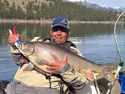
jed with a spring Big Mack
 

Topic: MA-6 Boundaries  (Read 3862 times)

0 Members and 1 Guest are viewing this topic.

Northwoods

  • Sturgeon
  • *******
  • Formerly sumpNZ
  • Location: Sedro-Woolley, WA
  • Date Registered: Nov 2011
  • Posts: 2308
I'm trying to figure out exactly what the MA-6 boundaries are.  The regs state "... Smith Island to the Lawson Reef Buoy to Northwest Island to the Initiative 77 marker on Fidalgo Island ...".  But the I see other publications by WDFW that say it's "... Smith Island to the Initiative 77 marker on Fidalgo Island ...".

Which is it?

And where exactly is the "Initiative 77 Marker" on Fidalgo Island?  Perhaps my Google Fu is weak, but I cannot find exactly where it is located.

This might make a difference in where I drop shrimp pots this year due the much longer season in MA-6.
Formerly sumpNZ
2012 ORC 5th Place


demonick

  • Sturgeon
  • *******
  • Domenick Venezia, Author
  • Date Registered: Apr 2009
  • Posts: 2835
I love a challenge.  Here is the original text from the 1935 law resulting from the 1934 Initiative 77 to the People of WA State which defined some limitations on commercial salmon fishing.  Somewhere in there is the definition of the "Initiative 77 Marker".

http://www.leg.wa.gov/CodeReviser/documents/sessionlaw/1935pam1.pdf

"Be it enacted by the People of the State of Washington:

SECTION 1. It shall be unlawful to fish for, catch, or take any species of salmon or salmon trout, trout, Fishing; or steel head, except as hereinafter provided, with regulation of. any appliance, or by any means whatever, except . with hook and line, commonly called angling or trolling, except as hereinafter provided, within the waters of the straits of Juan de Fuca, Puget Sound and waters connected therewith within the State of Washington described as lying to the southerly, easterly and southeasterly of a line described as follows:

Commencing at a concrete monument on Angeles Point in Clallam County, State of Washington, near the mouth of the Elwha River, on which is inscribed "Angeles Point Monument" in the latitude 48 9' 3" north, longitude 123 33' 01" west of Greenwich Meridian; thence running east on a line 81 30' true from said point across the Flashlight and bell buoy off Partridge Point and thence continued to where said line intersects longitude 122 40' west; thence north on said line to where said line intersects the southerly shore of Sinclair Island at high tide; thence along the southerly shore of said island to the most easterly point thereof ; thence north 46 east true to the line of high tide at Carter Point, the most southerly point on Lummi Island; thence northwesterly along the westerly shore line at high tide of said Lummi Island to where said shore line at high tide intersects line of longitude 122 40' west; thence north on said line to where said line intersects the mainland at the line of high tide; including within said area the southerly por- tion of Hale Passage, Bellingham Bay, Padilla Bay, Fidalgo Bay, Guemes Channel, Skagit Bay, Similk Bay, Saratoga Passage, Holmes Harbor, Possession Sound, Admiralty Inlet, Hoods Canal, Puget Sound and all inlets, passages, waters, waterways, and the tributaries thereof. (The above area is delineated on U. S. Coast and Geodetic Charts Numbers 6300, 6382, 6380, 6450 and 6460, all being of the same scale.)"

If you plot the Partridge Point point, then east to longitude 122 40'W and north to Sinclair Island, the longitude 122 40'W line intersects Fidalgo Island at two points:

The very north end of Rosario Beach at  48° 25.225'N 122° 40.000'W

Along the south shore of Langley Bay at  48° 26.590'N 122° 40.000'W

What it boils down to is where the 122° 40.000'W longitude line intersects Fidalgo island. The MA6 definition in the WDFW pamphlet points to Reservation Head which is about 0.5 nm SE of the point on the north end of Rosario Beach.
« Last Edit: April 16, 2013, 09:32:08 AM by demonick »
demonick
Author, Linc Malloy Legacies -- Action/Adventure/Thrillers
2021 Chanticleer Finalist - Global Thriller Series & High Stakes Fiction
Rip City Legacy, Book 6 latest release!
DomenickVenezia.com


Northwoods

  • Sturgeon
  • *******
  • Formerly sumpNZ
  • Location: Sedro-Woolley, WA
  • Date Registered: Nov 2011
  • Posts: 2308
I sent the same question to WDFW.  I'll post the response if I ever get one.

What it boils down to is where the 122° 40.000'W longitude line intersects Fidalgo island. The MA6 definition in the WDFW pamphlet points to Reservation Head which is about 0.5 nm SE of the point on the north end of Rosario Beach.

The regs seperatly call out the line from Reservation Head to West Point as a seperate boundary line for the MA-6 to MA-8 boundary.

I'm thinking then that the I-77 marker referenced in the definition of MA-6 would be that point on the north end of Rosario Beach.
Formerly sumpNZ
2012 ORC 5th Place


Northwoods

  • Sturgeon
  • *******
  • Formerly sumpNZ
  • Location: Sedro-Woolley, WA
  • Date Registered: Nov 2011
  • Posts: 2308
Well, I did finally get a response from WDFW.  Here's the answer.

Quote from: Officer Ralph Downes
Hi Andrew,
   Please give me a call at your convenience and I’ll be happy to point you in the right direction.  My cell number is 360-xxx-yyyy.  I’m not sure how far along Ericka was able to assist, but I’ll give you a quick summery.  The Initiative 77 Marker is a stripe on the rock wall of Fidalgo Island, just northeast of Northwest Island.  It is located at approximately 48 25.237’ N by 122 40.111’ W.  The mark needs another coat of paint, but it is still visible.  Basically the eastern end of the Marine Area (MA) 6/7 line starts at the I-77 Marker and runs southwesterly to the Lawson Reef Buoy.  This line intersects with the northern portion of Northwest Island.  The mention of Northwest Island is merely because the line from the I-77 Marker to Lawson Reef Buoy crosses the island.  From the Lawson Reef Buoy the line then continues southwesterly to Smith Island.  We don’t have a point on Smith where the line lands, so pick either the north or south shore, whichever works best for what you want to do.  When dealing with the open MA 6 fisheries I use the northern point of Smith Island.  This gives the largest possible size for MA 6.  From Smith Island the line then continues southwesterly to the “R” Traffic Separation Buoy that is located at approximately 48 16.438’ N by 123 06.570’ W.  I hope this helps.  Give a call or drop me a line anytime and I’ll be happy to help in any way that I can…………Ralph


Officer Ralph Downes
Washington Department of Fish and Wildlife
Law Enforcement Program
Region 4 Marine Division
Formerly sumpNZ
2012 ORC 5th Place


demonick

  • Sturgeon
  • *******
  • Domenick Venezia, Author
  • Date Registered: Apr 2009
  • Posts: 2835
I fished Rosario last June and look what I found in the photos!  The shot is taken from just off Rosario Head.  Resolution is not great. To the left is Northwest Island across Rosario Bay. To the right are Urchin Rocks just off Rosario Head.  The view is close to True North.  The vertical white I-77 strip is center frame.  The blue roofed house to the right is over the north end of Rosario Beach. 

Google Earth puts the distance between the west corner of the blue roof house and the west corner of the next building to the east at 105'.  That reference puts the I-77 stripe 630' west of the west corner of blue roof.

That puts the stripe at 48 25.230 N 122 40.066 W.

I'll be there later this week and will try for a better photo.
« Last Edit: April 29, 2013, 12:57:55 PM by demonick »
demonick
Author, Linc Malloy Legacies -- Action/Adventure/Thrillers
2021 Chanticleer Finalist - Global Thriller Series & High Stakes Fiction
Rip City Legacy, Book 6 latest release!
DomenickVenezia.com


demonick

  • Sturgeon
  • *******
  • Domenick Venezia, Author
  • Date Registered: Apr 2009
  • Posts: 2835
Closeup of the I-77 stripe at Rosario Beach.  This is the dividing line between MAs 6 and 7.  48 25.224 N 122 40.083 N
demonick
Author, Linc Malloy Legacies -- Action/Adventure/Thrillers
2021 Chanticleer Finalist - Global Thriller Series & High Stakes Fiction
Rip City Legacy, Book 6 latest release!
DomenickVenezia.com


Northwoods

  • Sturgeon
  • *******
  • Formerly sumpNZ
  • Location: Sedro-Woolley, WA
  • Date Registered: Nov 2011
  • Posts: 2308
I did see that yesterday while I was out shrimping.  Don't know why I'd never noticed it beforen
Formerly sumpNZ
2012 ORC 5th Place


anything