Welcome, Guest. Please login or register.
May 14, 2025, 02:16:42 AM

Login with username, password and session length

Recent Topics

[May 13, 2025, 07:13:39 PM]

[May 11, 2025, 09:36:38 AM]

[May 08, 2025, 09:53:46 AM]

[May 05, 2025, 09:12:01 AM]

[May 03, 2025, 06:39:16 PM]

by jed
[May 02, 2025, 09:57:11 AM]

[May 01, 2025, 05:53:19 PM]

[April 26, 2025, 04:27:54 PM]

[April 23, 2025, 11:10:07 AM]

by [WR]
[April 23, 2025, 09:15:13 AM]

[April 21, 2025, 10:44:08 AM]

[April 17, 2025, 04:48:17 PM]

[April 17, 2025, 08:45:02 AM]

by jed
[April 11, 2025, 01:03:22 PM]

[April 11, 2025, 06:19:31 AM]

Picture Of The Month


Guess who's back?
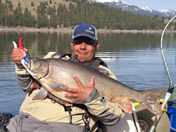
jed with a spring Big Mack

Topic: Distance and Speed  (Read 1795 times)

0 Members and 1 Guest are viewing this topic.

Pinstriper

  • Sturgeon
  • *******
  • Location: Outer Southwest Portlandia
  • Date Registered: May 2015
  • Posts: 1043
Went out of Cook Park and paddled upstream to the 99w bridges last weekend. That's a round trip of just a bit under 4 miles. I've paddled farther tooling around Hagg, though spread out with more stops along the way to fish or just look around. Other than for the heat I could have kept going, but Mrs. P was really at her limit.

So I'm wondering how far folks plan on their trips on, say, the Willy, or Multnomah Channel, or heaven forbid, coastal rivers and bays such as Nehalem ?

Especially when one has to take paddling against the current into account.

Also, as we're paddling back, up from behind me comes this powerboat. On the Tualatin. Seriously.

So I ask him where he came from and he says he puts in at Cook. I ask isn't it a bit shallow for his boat ? He says "I've been on this river for 50 years, so I know every rock and stump out here....Usually!" So he threads his way along to one side. Anyway I'm paddling along not particularly hard and keeping up with him and he says "you're doing 3.5 mph, and I bet you could probably do 4.5". I've sprinted much faster than I was paddling at the time.

Which got me to thinking about how that compares with other folks paddling, and along with endurance/distance, what figures you folks use to plan how far you are going to go and in what conditions, and what I'd need to be able to do before taking on some of the aforementioned waters ?

Thanks in advance.
Let's eat, Grandma !
Let's eat Grandma !

Punctuation. It saves lives.
........................................................................


dandj1958

  • Rockfish
  • ****
  • I fish like a girl
  • Location: Salem, OR
  • Date Registered: Aug 2014
  • Posts: 128
I bought a cool app for my phone- Trimble Outdoors navigation.  It records my trips on the water and then shows me the route on a map, total time and avg pace.

Most of our trips are 4-5 miles at a slow pace due to us trolling while fishing.  The longest recently was 6:20 hours to do 10.13 miles down at Foster lake.  I think the app only cost about $4.  I wish I would have had it at Lake Tahoe last year.

Speed isn't something we are normally worried about when fishing but I know we can go pretty fast with our peddles.
Julie
AKA mrs. dannybay
2015 Hobie Revo 11
2012 Hobie Revo 11


Noah

  • Sturgeon
  • *******
  • Cabby Strong!
  • Location: Tigard
  • Date Registered: Mar 2011
  • Posts: 3596
I think my longest days were 18 miles and an estimated 22. My fish finder battery died on both days so I'm not 100% sure but they were pretty close. Both days were fishing pretty far offshore and included drifts but also lots of pedaling against strong current.


Tinman

  • Herring
  • **
  • Location: Portland
  • Date Registered: Jan 2015
  • Posts: 42
I like to row for exercise as well as fishing.  Last Saturday I rowed 25 miles in the Willy (Willamette Park to head of the Multnomah Channel and back).  My longest row was 43 miles in 9 hours (St Johns bridge to Clackamas River mouth and back).  Average speed is 3.8 mph, including breaks.  High cruising speed is 4.3 mph. 

I haven't paddled much but I think rowing and paddling are two entirely different animals.


C_Run

  • Sturgeon
  • *******
  • Location: Independence, OR
  • Date Registered: Apr 2011
  • Posts: 1239
Lacking fancy gadgets, I try to figure out my distance approximately with Google Earth after a long trip. So far  my longer trips have been in the 9-12 mile range in lakes or upper tidewater situations where current isn't much of a factor. But, When you are trolling less than two miles per hour and there is only so much daylight, you can only travel so far.

It never fails that when I try to plan a trip and use the tides to my advantage, a strong wind will come up and blow the exact opposite direction of where I am trying to go. In that case, a mile seems like forever.


Fungunnin

  • Sturgeon
  • *******
  • Date Registered: Aug 2010
  • Posts: 2548
I like to row for exercise as well as fishing.  Last Saturday I rowed 25 miles in the Willy (Willamette Park to head of the Multnomah Channel and back).  My longest row was 43 miles in 9 hours (St Johns bridge to Clackamas River mouth and back).  Average speed is 3.8 mph, including breaks.  High cruising speed is 4.3 mph. 

I haven't paddled much but I think rowing and paddling are two entirely different animals.
If you have a sliding seat then they are completely different.
Never did a lot of distance rowing but have done 26 miles in an 8 man shell in about 4 hours.
Love the slide of a balanced racing shell. =)


Tinman

  • Herring
  • **
  • Location: Portland
  • Date Registered: Jan 2015
  • Posts: 42
Sorry,  I forgot to mention the wherry is fixed-seat.  I use 8 foot spruce oars - spoon blade for flat water and straight blade for rough water. 


Pinstriper

  • Sturgeon
  • *******
  • Location: Outer Southwest Portlandia
  • Date Registered: May 2015
  • Posts: 1043
I lack the gadgets too and also measure with google maps. I am trying to get a sense for the planning so I can say "here is how far I can go from the launch point before turning back". I am quite sure pedalers have a longer range than us paddlers - something that will keep me off the ocean until I get the Hobie.
Let's eat, Grandma !
Let's eat Grandma !

Punctuation. It saves lives.
........................................................................


Tinman

  • Herring
  • **
  • Location: Portland
  • Date Registered: Jan 2015
  • Posts: 42
I lack the gadgets too and also measure with google maps. I am trying to get a sense for the planning so I can say "here is how far I can go from the launch point before turning back". I am quite sure pedalers have a longer range than us paddlers - something that will keep me off the ocean until I get the Hobie.

You can get GPS smartphone apps.  If you can find one with the "trip computer" function, it would have an odometer function that tells how far you have gone, plus your peak and average speed.  Such apps are free or cheap.  The only other thing you need is a $20 battery-based smartphone recharger.  These are about the size of a smartphone and will recharge your phone 4 or 5 times. 


Fungunnin

  • Sturgeon
  • *******
  • Date Registered: Aug 2010
  • Posts: 2548
Sorry,  I forgot to mention the wherry is fixed-seat.  I use 8 foot spruce oars - spoon blade for flat water and straight blade for rough water.
43 miles in a fix seated boat is some solid work! Rowing does allow you to use your back a lot more than paddling though. Sounds Like fun! =)


yakbass

  • Lingcod
  • *****
  • Location: N. Portland
  • Date Registered: Mar 2015
  • Posts: 205
15 miles at la Jolla in one day was no problem average speed 1.5mph. Some with and some against the current. 5 miles in Tillamook to rescue a crab pot 2.5 into the wind and current average speed 2.3 mph and I was done. Just depends on the day. Average cruise speed In a trident 15 for me is 3 mph  sprint 5.5 mph.


anything