Welcome, Guest. Please login or register.
August 29, 2025, 03:00:53 AM

Login with username, password and session length

Recent Topics

[August 28, 2025, 07:56:51 PM]

by jp52
[August 28, 2025, 05:22:27 PM]

[August 22, 2025, 07:40:31 PM]

[August 20, 2025, 01:02:31 PM]

[August 19, 2025, 08:25:11 AM]

by PNW
[August 16, 2025, 10:51:59 AM]

[August 15, 2025, 05:52:58 PM]

[August 12, 2025, 06:14:41 PM]

[August 08, 2025, 12:28:19 PM]

[August 08, 2025, 11:19:57 AM]

[August 08, 2025, 11:11:23 AM]

[August 08, 2025, 10:59:41 AM]

[August 07, 2025, 07:03:21 AM]

by jed
[August 05, 2025, 07:31:48 PM]

[August 02, 2025, 05:52:47 PM]

Picture Of The Month


Guess who's back?
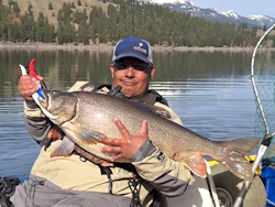
jed with a spring Big Mack

Topic: Ocean window this Saturday?  (Read 2926 times)

0 Members and 1 Guest are viewing this topic.

YippieKaiyak

  • Lingcod
  • *****
  • Location: Hillsboro, OR
  • Date Registered: Feb 2017
  • Posts: 349
How does one "watch the buoys"?  I just learned that magic seaweed was a web site this morning... clearly have a lot to learn :)
Kayaking without wearing a PFD is like drunk driving.  You can get away with it for a while, but eventually someone dies.


crash

  • Salmon
  • ******
  • Location: Humboldt, CA and Ashland, OR
  • Date Registered: Jan 2012
  • Posts: 813
How does one "watch the buoys"?  I just learned that magic seaweed was a web site this morning... clearly have a lot to learn :)

MSW has live reports from automated weather stations and buoys.  They typically report once an hour with air and sea temp, wave period, wave height, and wind.  You can match the trend of the actual recent condition observations with the forecast to aid in planning your day.

MSW live reports are usually my last gametime decision tool that I use from home before I get to the launch.  I essentially use it to make the decision of whether or not to get out of bed.


YippieKaiyak

  • Lingcod
  • *****
  • Location: Hillsboro, OR
  • Date Registered: Feb 2017
  • Posts: 349
Thanks, Crash.  I'll have to start checking it out to see if I can make sense of the trends.  Is there a standard for acceptable, optimal, or no go conditions to look for?
Kayaking without wearing a PFD is like drunk driving.  You can get away with it for a while, but eventually someone dies.


crash

  • Salmon
  • ******
  • Location: Humboldt, CA and Ashland, OR
  • Date Registered: Jan 2012
  • Posts: 813
Thanks, Crash.  I'll have to start checking it out to see if I can make sense of the trends.  Is there a standard for acceptable, optimal, or no go conditions to look for?

Not really.  I mean, I like to start with

If swell in ft <= .5 period in seconds;
and
swell in ft + wind in kts <= 20

then go

else no go.

But that's just a starting point.  A 3' south swell at 22 seconds is going to wreak a ton of havoc on a south facing launch.  Local bathymetry plays a big roll in a go/no go decision too.  So wind and swell and period and direction of all of the above, secondary and tertiary swells and directions, and exposure of the launch.  The best thing to do is to compare forecast with actual observed conditions over time at your desired launch site.  That's easier for us coastal guys to do than for someone who lives inland.

And to be clear, that formula isn't the end all and be all, its just quick and dirty.  I've been out in much worse, and I've made no go decisions in less.  Location, location, location.


Tinker

  • Sturgeon
  • *******
  • Kevin
  • Location: 42.74°N 124.5°W
  • Date Registered: May 2013
  • Posts: 3338
Or you can go directly the National Data Buoy Center at http://www.ndbc.noaa.gov/ and see the real-time buoy data and day-by-day trends.  You can see swell height, swell period, significant wave height, wind speed and direction, and gusts...  The buoys don't tell you if it's raining but I've seen that MSW is seldom right about rain, even when it's clearly raining heavily.

And, checking a number of stationary meteorological buoys up and down the coast can give you a good idea about what might be coming.

Tell me to go look a the buoys, and I get carried away!
The fish bite twice a day - just before we get here and right after we leave.


rawkfish

  • ORC
  • Sturgeon
  • *
  • Cabby Strong!
  • youtube.com
  • Location: Portland
  • Date Registered: Mar 2009
  • Posts: 4731
Absolutely Tinker. Let us all not forget that Magicseaweed.com is not the only website for determining what the ocean may look like. The smart way to do it is to check a few sites when making plans for hitting the salt. They all use different models to create their forecast. 

Sent from my Moto G Play using Tapatalk

                
2011 Angler Of The Year
1st Place 2011 PDX Bass Yakin' Classic
"Fishing relaxes me.  It's like yoga except I still get to kill something."  - Ron Swanson


YippieKaiyak

  • Lingcod
  • *****
  • Location: Hillsboro, OR
  • Date Registered: Feb 2017
  • Posts: 349
Thanks!  I've got my homework cut out for me.  I realize it's much more complex but without exposure to it I've always just had the idea that waves move east to west (on pnw beaches) and that's about it.  Trying to fish off the jetty showed me how much tidal currents impact things.  Ive been scuba diving all over but never dealt with launching from a beach (or dealing with the boat) so it's all new.
Kayaking without wearing a PFD is like drunk driving.  You can get away with it for a while, but eventually someone dies.


Tinker

  • Sturgeon
  • *******
  • Kevin
  • Location: 42.74°N 124.5°W
  • Date Registered: May 2013
  • Posts: 3338
Thanks, Crash.  I'll have to start checking it out to see if I can make sense of the trends.  Is there a standard for acceptable, optimal, or no go conditions to look for?

Everything that crash already said, plus wind direction vs. swell direction, and primary wave direction vs. secondary direction vs. wind swell direction...

A wind opposing the swell will make a steeper wave face, where a wind coming from behind will flatten the swell somewhat and a five-footer doesn't feel intimidating, but whenever the various swells are coming from different directions, it's going to be a bumpy ride regardless of swell height and Dramamine is in order.

It's complicated and it's personal, but these are what I'm watching out for, and the go/no go decision still comes at the beach.
« Last Edit: March 07, 2017, 09:10:42 AM by Tinker »
The fish bite twice a day - just before we get here and right after we leave.


rawkfish

  • ORC
  • Sturgeon
  • *
  • Cabby Strong!
  • youtube.com
  • Location: Portland
  • Date Registered: Mar 2009
  • Posts: 4731
Thanks, Crash.  I'll have to start checking it out to see if I can make sense of the trends.  Is there a standard for acceptable, optimal, or no go conditions to look for?

Here are a couple of hints: the home page of NWKA, and stickied threads in the most frequented boards of NWKA. ;)

Sent from my Moto G Play using Tapatalk

                
2011 Angler Of The Year
1st Place 2011 PDX Bass Yakin' Classic
"Fishing relaxes me.  It's like yoga except I still get to kill something."  - Ron Swanson


crash

  • Salmon
  • ******
  • Location: Humboldt, CA and Ashland, OR
  • Date Registered: Jan 2012
  • Posts: 813
Absolutely Tinker. Let us all not forget that Magicseaweed.com is not the only website for determining what the ocean may look like. The smart way to do it is to check a few sites when making plans for hitting the salt. They all use different models to create their forecast. 

Sent from my Moto G Play using Tapatalk

I use windytv, magicseaweed, and sailflow.  Magic seaweed tends to be the best for inshore conditions if they have a report for your launch spot.  It's designed for surfers.  NOAA is usually not as reliable.  I think they forecast for worst case for the entire zone forecast instead of for expected conditions inshore.

Thanks!  I've got my homework cut out for me.  I realize it's much more complex but without exposure to it I've always just had the idea that waves move east to west (on pnw beaches) and that's about it.  Trying to fish off the jetty showed me how much tidal currents impact things.  Ive been scuba diving all over but never dealt with launching from a beach (or dealing with the boat) so it's all new.

The predominant swell is out of the NW to WNW.  A hurricane in the south pacific can send a 2'-4' long period south swell at 20+ seconds, which will cause sneaker waves and big runups.  The longer the period, the more energy is in the wave, and the higher it can run up on a beach or break on reefs, while not being too noticable when you are out on the water.  If you take it to its logical extreme to illustrate a point, a tsunami wave is a 3' wave with a period of 20 minutes or so.


  • WS Commander 120, OK Trident 13, Revo 13
  • Location: Creswell OR
  • Date Registered: Jan 2011
  • Posts: 804
Or y'all can plan on launching out of Sunset and not have to worry about a surf launch at all. Depoe Bay is another option if the hole is open and swell/period and wind allows. Sunset will provide a bit more protection, and would be the recommended spot for any newbies. Location. Right!
Better to keep ones mouth shut and presumed a fool than to open it and remove all doubt.
<Proverbs>


Tinker

  • Sturgeon
  • *******
  • Kevin
  • Location: 42.74°N 124.5°W
  • Date Registered: May 2013
  • Posts: 3338
You're absolutely right that launching in a sheltered bay is optimal, regardless of experience level, but you still have to know the conditions in open water if you plan to leave the bay...
The fish bite twice a day - just before we get here and right after we leave.


Clayman

  • Salmon
  • ******
  • Location: Newport, OR
  • Date Registered: Feb 2017
  • Posts: 830
Weather window got eaten.  Oh well, at least Sunday is looking like a good day to chase steelhead  :).
aMayesing Bros.