Welcome, Guest. Please login or register.
June 20, 2025, 10:37:58 PM

Login with username, password and session length

Recent Topics

[June 18, 2025, 01:58:02 PM]

[June 13, 2025, 07:00:13 PM]

[June 13, 2025, 02:51:47 PM]

[June 12, 2025, 06:51:40 AM]

[June 06, 2025, 09:02:38 AM]

[June 04, 2025, 11:55:53 AM]

[June 03, 2025, 06:11:22 PM]

[June 02, 2025, 09:56:49 AM]

[June 02, 2025, 09:06:56 AM]

by jed
[May 31, 2025, 12:42:57 PM]

[May 26, 2025, 09:07:51 PM]

[May 25, 2025, 12:50:42 PM]

[May 25, 2025, 09:15:49 AM]

[May 24, 2025, 08:22:05 PM]

[May 22, 2025, 05:09:07 PM]

Picture Of The Month


Guess who's back?
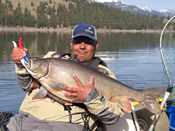
jed with a spring Big Mack

Topic: Why a GPS is a good idea...  (Read 3296 times)

0 Members and 1 Guest are viewing this topic.

Yarjammer

  • Salmon
  • ******
  • Captain of the Titanic
  • Location: Marysville, Wa.
  • Date Registered: May 2008
  • Posts: 911
I learned a valuable lesson Saturday evening at Silver Lake- GPS isn't just for the ocean.   :-[

After lunch I headed out in the general direction as Pole, Z, & P_S_R and got sidetracked by a promising canal.  I managed to weave through it and various other channels through some of the islands pretty much for the rest of the day.  As the shadows grew much longer and it was time to head back to familiar territory I came to the somewhat frightening realization I no freaking idea where I was on the lake.  I studied the shoreline and pick my plan of attack to make it back to the launch...  50/50-90% ruled once again; I ended up going further away from my desired destination.  With no response on the VHF from anyone, I managed to flag down a john boat cruising by to point me in the right direction.  One thing is for sure- I would have been on that lake until first light Sunday morning had I not talked to this guy.  This guy offered me a tow back to the vicinity of the launch and I took him up on it without hesitation.

Before I hit up another unfamiliar lake I will be arming myself with a lake map and a compass or a GPS.       

...and if your curious, an OK Prowler 13 is capable of planing behind a 6hp motor at full throttle.  :o


Spot

  • Administrator
  • Sturgeon
  • *****
  • Cabby Strong!
  • Location: Hillsboro
  • Date Registered: Jul 2007
  • Posts: 5959
It takes a big man to admit a mistake so that others can be fore-armed.

Glad to hear you made it back safely!!!  Did you ever find 'Yak Monkey?

BTW: Nice meeting you this weekend! 
Twenty years from now you will be more disappointed by the things you didn't do than by the ones you did do. So throw off the bowlines. Sail away from the safe harbor. Catch the trade winds in your sails. Explore. Dream. Discover.  --Mark Twain

Sponsors and Supporters:
Team Daiwa        Next Adventure       Kokatat Immersion Gear

Tournament Results:
2008 AOTY 1st   2008 ORC 1st  2009 AOTY 1st  2009 NA Sturgeon Derby 1st  2012 Salmon Slayride 3rd  2013 ORC 3rd  2013 NA Sturgeon Derby 2nd  2016 NA Chinook Showdown 3rd  2020 BCS 2nd   2022 BCS 1st


boxofrain

  • Sturgeon
  • *******
  • Location: Brookings, Or.
  • Date Registered: May 2006
  • Posts: 1015
gald to hear you made it safely home!
 I usually pack some food stuff in a pack or my plano box for just this type of situation.
 I have a small survival kit I have stuffed into a plastic Miracle Whip jar, for me.
 I have another survival kit for the Yak in a smaller bottle as well. ;)


( I used to be a Boy Scout  ::) )
the memories of a man in his old age, are the deeds of a man in his prime.


[WR]

  • Sturgeon
  • *******
  • VFW, Life Member at Large, since 1997.
  • Location: currently 17870
  • Date Registered: Jan 2008
  • Posts: 4752
It takes a big man to admit a mistake so that others can be fore-armed.

Glad to hear you made it back safely!!!  Did you ever find 'Yak Monkey?

BTW: Nice meeting you this weekend! 

I got back to the resort launch about 4:30 or so and 'Monkey was already back on shore warming up.. he'd gone to the far western end of the lake most of the day from what he told me..that had to be after Yar and i split from him around 10 am. he told me when we met that evening that his radio batteries had crapped out on him some time mid day so he had not been able to contact us at all.

Yar, don't beat yourself up about this.. like we talked about after you got back to the launch point, ok?


polepole

  • Administrator
  • Sturgeon
  • *****
  • NorthWest Kayak Anglers
  • Location: San Jose, CA :(
  • Date Registered: Apr 2006
  • Posts: 10099
Here's my story of how my GPS ownership came to be.  I went out fishing from Davenport, CA one day.  Actually it was the first time I mean Bill of NCKA.  I met him at the landing after we had both came in and we shared similar stories.  And we both bought GPS' that week.  While we were out there the fog rolled in big time to the point that you could not see land.  I think the swell also changed up slightly on us, because it took me a long time to paddle in, at least the direction I thought I should have been going.  After a while I heard this loud pounding sound and realized that I was off of the rock quarry which was ~1 mile south of the landing.  So I turned and paddled back north.  At one point I found myself just outside the surf break talking to a couple of surfers who told me I shouldn't be that close to the surf break because I was too near a spot that would sneak up on me if a good swell came through.  While normally I would think that to be kind of fun, back then I was paddling a Cobra Triple ... solo!!!  You can't surf that yak.  Ask me how I know.   ::)

-Allen


Yarjammer

  • Salmon
  • ******
  • Captain of the Titanic
  • Location: Marysville, Wa.
  • Date Registered: May 2008
  • Posts: 911
This just goes to prove that no matter how smart or prepared you think you are, there is always a lesson just waiting to be taught.  I guess school was in session for me on Saturday.  A lesson learned should be a lesson shared IMHO.

Anyone have any personal favorite GPS units... (or lessons learned the hard way.)  Is a non-mapping GPS worth it or should I hold off and get one with mapping capability?  I have been looking closely at the Garmin GPSmap 60Cx or 60CSx, but it will be a month or so before I can drop the coin on it.  I think any GPS could have helped me this weekend so long as I remembered to mark the launch as a waypoint.


  • I fish out of a SIK
  • blah...
  • Location: Milwaukie, Oregon
  • Date Registered: Jun 2008
  • Posts: 366
Anyone have any personal favorite GPS units... (or lessons learned the hard way.)

Yes, if your going to not dress for submersion, just for the warmth, you better make sure your drybag with your towel/change of clothes is actually in your 'yak not a across the lake in the car... D'oh

I dunno how many times I've packed that dry-bag in the hatch... I guess after so many trips without dumping the boat I got lazy and just started leaving it in the car...

My dog needed to go to shore, so I paddled over to this little island in this channel.  I was being lazy instead of just stepping in a few inches of water, I tried to do this balancing act and step a ways directly onto the bank. Totally misjudged on the distance and my foot slid down the mud, and i fell backwards over my yak-headfirst into the water (somehow my pole was ok). My kayak was turned on its side, filling it with water...  I believe the temperature outside was something like 36...

When I started pumping out the water from my yak, a couple of goats randomly came out of nowhere on the little island to investigate what i was doing. 

Took about an hour to get back to dry clothes.  I had silk long underwear on, jeans (that's what sucked), wool socks, some fleece layers.  My legs were really the only thing that got too cold, steam was coming off them pretty steady as I paddled back.

So ya, don't feel bad Yar, at least you didn't fall in getting out of your kayak.  And you did better fishing than me, I got totally skunked.  I spent more time trying to find people on the water, and then trying to play catch-up then fish.  At least you were investigating promising channels, instead of just going in circles...

Lessons learned on my end though, so I guess the trip was worth it.  Lunch was definitely the best part for me haha.  Was good to meet all of you.


yessnoo

  • Lingcod
  • *****
  • Location: Seabrook, TX
  • Date Registered: Apr 2008
  • Posts: 456
ok well i don't have a getting lost yak story...yet...but i am sure i will have one soon

i do however have a powerboat story...i was on Lake Murray in columbia, south carolina (also where i am from)...i usually take the boat out to lake wateree which is about half the size of lake murray....(i believe Lake Murray is the sixth largest man made lake)
lake murray is a lake with many many many coves and peninuslas and islands and shoreline and wat not....me and my friend from school in florida took spring break at my house in south carolina...so i say lets get some people and take the boat out....so there are 4 of us and we set off to the lake...first mistake was i got lost going there because i was trying to find a particular landing and basically got lost and found the wrong landing which happened to be better anyways...so at this point i don't know really where i am and i am launching a boat into the lake lol...so we go out for watever reason i wasn't paying much attention to the launch site cause it had power lines over the water and i thought it was a very easy landscape to pick out...which actually it kinda was...so we are out kneeboarding and tubing for about 4 hours and i am getting low on gas so i say we had better start heading back...so i start going back to where i think the cove the landing is in....i can't find it....i rode basically the coastline from the dam to dreher island....if you look at a map you will see that is a very long ways...ive been riding coastline for a couple hours now...the gas gauge is below empty...i started calling friends and relatives for directions to a boat ramp that i didn't know the name of and didn't know the location of except that i knew it was between the damn and dreher island...thats probably only 15 or 20 miles in a straight line lol

long story short after about an hour on the phone with my dad on google earth and me explaining where i thought it was (all of this while sitting on some strangers dock lol)   he told me where it was....it was in a cove in such a way that you can't see it unless u go pretty far back in there....we actually ran out of gas before we got to the dock....so i just jumped out and swam the boat the rest of the way lol....my friends and i were pretty sunburned....they weren't super happy about it either...go figure

i kinda made the same mistake of thinking how can i get lost on a lake....bad mistake lol
2008 Hobie Mirage Revolution Fish


coosbayyaker

  • Sturgeon
  • *******
  • "Hooky Thing"
  • Location: Coos Bay Oregon
  • Date Registered: Oct 2007
  • Posts: 3862
GPS is a good idea when your on the ocean in 20 foot vis. fog when the only direction your 100 percent sure of is down, cause the water is there. And you hear pounding waves somewhere just beyond that 20 feet and know that's not the friendly cove you launched out of.

From experience i can't really recommend much, My FF/GPS is the first GPS unit i've ever had but for yakking , with my seeming penchant for dunk testing(to failure) electronics, i like to keep as few on board as possible so combo units are good. It would be a pain to take on a hike though...
See ya on the water..
Roy


ZeeHawk

  • Administrator
  • Sturgeon
  • *****
  • Sauber is my co-pilot.
  • Location: Seattle, WA
  • Date Registered: Sep 2006
  • Posts: 5506
Thanks for posting your experience YJ. It's telling to see that we could get lost on a lake of all places and find ourselves in between a rock and a hard place. Good on you for getting proactive about a GPS and don't forget about backing it up as well. I pack a small compass in my PFD just in case my GPS/FF batteries fail.

Z
2010 Angler Of The Year
2008 Moutcha Bay Pro - Winner
Jackson kayaks, Kokatat, Daiwa, Werner Paddles, Orion, RinseKit, Kayak Academy


  • Don't ask me how I know!
  • Date Registered: Nov 2006
  • Posts: 1704
Wow, an experience I've had that's not an example of what not to do!
Well, sorta....

Yessnoo reminded me of what good fishing maps Google Earth printouts yield. They are great for finding ponds and cuts in the marsh (especially with a GPS!) and a picture is worth at least 1.5k words.


To wit, I was fishing Guano Lake (yes, as in bat shit) without one. It's a lovely little impoundment that's alternately flooded and drained according to a dam and the tide. It was supposed to be chocked full of Redfish, Specked Trout, some Snook, and lots of alligators. I was attempting to fish it just after the annual big drain as it concentrates bait and fish (well, it sounded good at the time ::)) I'd never fished there before but I'd heard that lake "A" was the spot to start.
 Much of Guano "lake" is marsh that's covered with 4' tall marsh grass (everything brown in the picture). At the bottom of the pic is a tall pine grove (green) and at the top is a 10' high embankment of mixed pines and palmettos. Above that is A1A and the Atlantic Ocean. This pic is a little better than a mile and a half wide. At kayak level, you really can't see much other than the water in front of you.

  The conventional route to "A" is that green line. But I saw a "canal" that looked like it ran straight to the lake to the left just after the launch. It did, but after a couple hundred yards it thinned to 6" deep. I pressed on figuring it'd get deeper towards the lake. It didn't.
I slogged through 3"-4" of water and 4' of mud for the next hour and a half (the red line). Did I mention that this was supposed to be a "quick" trip and I was supposed to done by noon? It was 9:30 before my boat could float again with me in it. (Point "A") Not so bad, so I fished back towards the launch and figured I'd go back up the canal that I was supposed to take in the first place (green line). 
 
 From this god-like perspective its obvious that I missed the canal ::)  So I paddled to point "B", then paddled towards what looked like a break in the trees and "must" be the parking lot. It is. Just the wrong one and it does not have a launch. I turned back and went a little further and went down a canal to point "C" where the water got skinny again and was not taking me to the launch. I paddled back and made that loop de loop and on to point "D" at which point I figured that I was lost and going to have to bushwhack through the pines to get to the road.

(Wait, I thought this was not supposed to be another example of what not to do?)

It is ;D

 After sweating the thought of more slogging though some lovely gator nesting spots for an interminably long 30 or 40 seconds, the light came on. I have a GPS/FF!!! I pushed some buttons, found my track and the canal that I was supposed to be in. (The M56's mapping function constantly surprises me with the level of detail it has in some places and not others  ??? )  I was waaay past it! I turned around and went home. Did'nt get back to the launch till about 1 pm, but I still made the 4:30 plane. (don't ask ::) )

Moral of the story? Learn how to use your tools (and don't forget that you have them) ;D
« Last Edit: October 14, 2008, 11:46:17 AM by Fishesfromtupperware »
"For when sleeping I dream of big fish and strong fights"


Yarjammer

  • Salmon
  • ******
  • Captain of the Titanic
  • Location: Marysville, Wa.
  • Date Registered: May 2008
  • Posts: 911
Great anecdote FFTW! 


ZeeHawk

  • Administrator
  • Sturgeon
  • *****
  • Sauber is my co-pilot.
  • Location: Seattle, WA
  • Date Registered: Sep 2006
  • Posts: 5506
Classic FFTW... just classic!

Z
2010 Angler Of The Year
2008 Moutcha Bay Pro - Winner
Jackson kayaks, Kokatat, Daiwa, Werner Paddles, Orion, RinseKit, Kayak Academy


anything