Welcome, Guest. Please login or register.
August 29, 2025, 11:40:49 AM

Login with username, password and session length

Recent Topics

[August 28, 2025, 07:56:51 PM]

by jp52
[August 28, 2025, 05:22:27 PM]

[August 22, 2025, 07:40:31 PM]

[August 20, 2025, 01:02:31 PM]

[August 19, 2025, 08:25:11 AM]

by PNW
[August 16, 2025, 10:51:59 AM]

[August 15, 2025, 05:52:58 PM]

[August 12, 2025, 06:14:41 PM]

[August 08, 2025, 12:28:19 PM]

[August 08, 2025, 11:19:57 AM]

[August 08, 2025, 11:11:23 AM]

[August 08, 2025, 10:59:41 AM]

[August 07, 2025, 07:03:21 AM]

by jed
[August 05, 2025, 07:31:48 PM]

[August 02, 2025, 05:52:47 PM]

Picture Of The Month


Guess who's back?
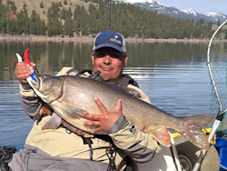
jed with a spring Big Mack

Topic: Ocean bathymetry  (Read 1734 times)

0 Members and 1 Guest are viewing this topic.

bb2fish

  • Sturgeon
  • *******
  • Location: Oregon
  • Date Registered: Feb 2013
  • Posts: 1501
Does anyone have a good source for detailed ocean floor bathymetry (depth)?  I was browsing on my GPS and I just don't get the detail I'd like.  Found some online NOAA charts and they have fairly coarse resolution too.  I'm looking for various structure around Newport to depoe bay and perhaps even up near pacific city.  Would be nice to do some trip planning and see some reefs and such to stay away from.


Clayman

  • Salmon
  • ******
  • Location: Newport, OR
  • Date Registered: Feb 2017
  • Posts: 830
This one's pretty slick.  Check out the PDF habitat maps.  Doesn't cover the entire coast, but does hit the popular areas like Depoe, Newport, PC, etc.

http://activetectonics.coas.oregonstate.edu/state_waters_download.htm

The Navionics Web App is a fun one for cruising around in too.

https://webapp.navionics.com/#boating@6&key=w%7CinGvhnsV
aMayesing Bros.


INSAYN

  • ORC_Safety
  • Sturgeon
  • *
  • **RIP...Ron, Ro, AMB, Stephen**
  • Location: Forest Grove, OR
  • Date Registered: Aug 2008
  • Posts: 5417
I like Navionics Web App as well. 

Once you zoom into the area you are interested in, just click on the little icon on the bottom left that looks like an upside down WIFI icon. This will give more detail.  Not perfect, but good as I can find.
 

"If I was ever stranded on a beach with only hand lotion...You're the guy I'd want with me!"   Polyangler, 2/27/15


MonkeyFist

  • Lingcod
  • *****
  • Location: Corvallis, OR
  • Date Registered: Feb 2013
  • Posts: 379
The web app is very useful when you are on the water.


bb2fish

  • Sturgeon
  • *******
  • Location: Oregon
  • Date Registered: Feb 2013
  • Posts: 1501
oh yeah, forgot about the Navionics website.  That is pretty good.  Thanks for the other links Clayman.


Helium Head

  • Lingcod
  • *****
  • Location: Outer NW Portland
  • Date Registered: Mar 2016
  • Posts: 379
Thanks for the links, I just spent way too much time browsing. Need to get ready for tomorrow at PC. Ive always been interested in hitting the twin rocks at Rockaway.
Hobie Revolution 13 olive
Hobie Revolution 13 yellow


RoxnDox

  • Salmon
  • ******
  • Native Propel
  • Location: Gig Harbor, WA
  • Date Registered: Sep 2013
  • Posts: 678
Does anyone have a good source for detailed ocean floor bathymetry (depth)?  I was browsing on my GPS and I just don't get the detail I'd like.  Found some online NOAA charts and they have fairly coarse resolution too.  I'm looking for various structure around Newport to depoe bay and perhaps even up near pacific city.  Would be nice to do some trip planning and see some reefs and such to stay away from.

Barb, are these the NOAA charts you are talking about?  https://maps.ngdc.noaa.gov/viewers/bathymetry/   There is some high-resolution imagery but only in some areas.  Most of the Oregon coast is the regular, lower res stuff, including the Depoe Bay region and south.  There is some imagery for Lincoln City northwards, though, that may be useful.  Best viewed on as large a screen as possible (sorta OK on an iPad, on a phone forget it)

If you open that link, let the whole global map load, then UNcheck the box "Multibeam Bathymetric Surveys" to get rid of the clutter.  Then Check the boxes for "BAG Color Shaded Relief Imagery" & "BAG Footprints" (if you want the boundaries), and zoom into Oregon's coast to see where they've got the additional data layers.  I also check the "DEM Color Shaded Relief Imagery" box because I think it gives a better feel for bathymetry when the above-water topography's included.


Jim
Junk Jigs "BEST USE OF ACTUAL JUNK" category - "That tape should have been a prized possession and not junk. That will be a collectors item in 30 years!” & “There sure is a lot of junk in there.”


bb2fish

  • Sturgeon
  • *******
  • Location: Oregon
  • Date Registered: Feb 2013
  • Posts: 1501
Thanks Jim. That's some good data. 
These were the charts I was looking at http://www.charts.noaa.gov/OnLineViewer/18003.shtml 
Was also looking at some Google Ocean (kinda like Google Earth but for the water) - there's an incredible amount of imagery.


  • WS Commander 120, OK Trident 13, Revo 13
  • Location: Creswell OR
  • Date Registered: Jan 2011
  • Posts: 804
This one's pretty slick.  Check out the PDF habitat maps.  Doesn't cover the entire coast, but does hit the popular areas like Depoe, Newport, PC, etc.

http://activetectonics.coas.oregonstate.edu/state_waters_download.htm


The PDF's are nice, but I never have been able to find a freeware or other software that I can use to open the GIS data directly to model the 3d layer imagery. Any suggestions? Is there something specific you use that you might suggest?
Better to keep ones mouth shut and presumed a fool than to open it and remove all doubt.
<Proverbs>


rawkfish

  • ORC
  • Sturgeon
  • *
  • Cabby Strong!
  • youtube.com
  • Location: Portland
  • Date Registered: Mar 2009
  • Posts: 4731
In my book this conversation is quickly wandering into the "Restricted to non-public conversations only" territory.    ;)
                
2011 Angler Of The Year
1st Place 2011 PDX Bass Yakin' Classic
"Fishing relaxes me.  It's like yoga except I still get to kill something."  - Ron Swanson


anything