Welcome, Guest. Please login or register.
May 01, 2025, 10:18:29 AM

Login with username, password and session length

Recent Topics

by [WR]
[April 30, 2025, 04:16:03 PM]

[April 29, 2025, 01:32:37 PM]

[April 26, 2025, 04:27:54 PM]

[April 23, 2025, 11:10:07 AM]

by [WR]
[April 23, 2025, 09:15:13 AM]

[April 21, 2025, 10:44:08 AM]

[April 17, 2025, 04:48:17 PM]

[April 17, 2025, 08:45:02 AM]

by jed
[April 11, 2025, 01:03:22 PM]

by jed
[April 11, 2025, 10:27:27 AM]

[April 11, 2025, 06:19:31 AM]

[April 07, 2025, 07:03:34 AM]

[April 05, 2025, 08:50:20 PM]

[March 31, 2025, 06:17:42 PM]

by jed
[March 29, 2025, 09:59:09 AM]

Picture Of The Month


Guess who's back?
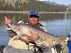
jed with a spring Big Mack

Topic: RIP Navionics Chart Viewer  (Read 1226 times)

0 Members and 1 Guest are viewing this topic.

Clayman

  • Salmon
  • ******
  • Location: Newport, OR
  • Date Registered: Feb 2017
  • Posts: 821
This was one of my favorite free resources for checking out bottom contours and substrate types. I recently learned that Garmin went in and dismantled the Chart Viewer last summer, and is now asking for 150 bucks for the same charts that were originally free to view on an internet browser.

Does anyone have a link to bathymetry resources similar to what the Chart Viewer provided? The charts available in NANOOS and iBoater are okay, but nowhere near as detailed as the Navionics charts.
aMayesing Bros.


skayaker2

  • Rockfish
  • ****
  • Since 2010. Formerly known as "skayaker"
  • TAFKAS (The Angler Formerly Known As Skayaker)
  • Location: Seattle
  • Date Registered: May 2018
  • Posts: 109
Yeah, that sucks, I used to use the free online NAVIONICS chart viever quite a bit, dissapointed they went away. There are some alternatives below, none I found with the detail level of Navionics charts.

https://fishing-app.gpsnauticalcharts.com/i-boating-fishing-web-app/fishing-marine-charts-navigation.html?title=Mason+Lake+boating+app#13.07/47.6436/-122.4398

https://nauticalcharts.noaa.gov/enconline/enconline.html

Having said that I just went to the following garmin link and somehow the SonarCharts seem to be available again. Wonder if it's only temporary but for now I can see it in an internet browser:
https://maps.garmin.com/en-US/marine?maps=another-brand&overlay=false&key=c22zjfypqzpy&heatmap=false

« Last Edit: April 17, 2025, 10:27:22 AM by skayaker2 »


snopro

  • Sturgeon
  • *******
  • Location: HR
  • Date Registered: Jun 2008
  • Posts: 1145
Still working for me on freshwater bathymetry.  I wonder if the bookmark I saved is getting me through some kind of backdoor.


kemfish

  • Perch
  • ***
  • Location: Eugene
  • Date Registered: Apr 2021
  • Posts: 84
This was a good alternative, however they have cut data usage if you don't have an account.  I don't and I don't know what is involved in getting one, info or $.  Just haven't tried.  Also didn't spend much time on learning how to properly us it, just grabbed a bookmark posted on some other site. Map coverage and detail looked good when I did use it though.

https://usa.fishermap.org/depth-map/willamette-river/
Keith

Old Town Sportsman 106 PDL


Clayman

  • Salmon
  • ******
  • Location: Newport, OR
  • Date Registered: Feb 2017
  • Posts: 821
Having said that I just went to the following garmin link and somehow the SonarCharts seem to be available again. Wonder if it's only temporary but for now I can see it in an internet browser:
https://maps.garmin.com/en-US/marine?maps=another-brand&overlay=false&key=c22zjfypqzpy&heatmap=false
This one is working for me too now. It was not working yesterday. Hope it sticks around. Thanks!
aMayesing Bros.


anything