Welcome, Guest. Please login or register.
May 07, 2025, 01:24:40 AM

Login with username, password and session length

Recent Topics

by jed
[May 06, 2025, 04:22:23 PM]

[May 05, 2025, 09:12:01 AM]

[May 03, 2025, 06:39:16 PM]

by jed
[May 02, 2025, 09:57:11 AM]

[May 01, 2025, 05:53:19 PM]

[April 26, 2025, 04:27:54 PM]

[April 23, 2025, 11:10:07 AM]

by [WR]
[April 23, 2025, 09:15:13 AM]

[April 21, 2025, 10:44:08 AM]

[April 17, 2025, 04:48:17 PM]

[April 17, 2025, 08:45:02 AM]

by jed
[April 11, 2025, 01:03:22 PM]

[April 11, 2025, 06:19:31 AM]

[April 07, 2025, 07:03:34 AM]

[April 05, 2025, 08:50:20 PM]

Picture Of The Month


Guess who's back?
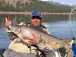
jed with a spring Big Mack

Topic: Handheld GPS Recomendations?  (Read 6881 times)

0 Members and 1 Guest are viewing this topic.

cjb

  • Rockfish
  • ****
  • Location: Seattle
  • Date Registered: Oct 2010
  • Posts: 172
I'm shopping around for a decent handheld GPS unit for use on the water and trail, and I am curious what recommendations you guys have.  I've been looking primarily at entry level mapping units.  The Garmin eTrex line looks interesting, but unfortunately REI doesn't bother to power up or load maps onto display units so I have no idea how nice screens are.

Also, are there any options out there that have map options that would include both fresh and salt waters of western Washington? 
-Craig

'12 Red Hobie Revo 11
"Red Rocket"


rawkfish

  • ORC
  • Sturgeon
  • *
  • Cabby Strong!
  • youtube.com
  • Location: Portland
  • Date Registered: Mar 2009
  • Posts: 4731
I love my Garmin eTrex Summit HC.  I wish it had expandable memory, but I haven't had problems with memory limitations so far.  It has a USB port to upload track and waypoint data or to save maps and waypoint data to the device.  It's waterproof but does not float.  It has a built in barometer which is really handy to keep an eye on changing weather conditions and also has a electronic compass so you don't have to be moving to know which direction you are facing.  The screen is easy to see in bright light conditions since you can choose your color scheme and set the display brightness.
                
2011 Angler Of The Year
1st Place 2011 PDX Bass Yakin' Classic
"Fishing relaxes me.  It's like yoga except I still get to kill something."  - Ron Swanson


Lee

  • Iris
  • Sturgeon
  • *******
  • Fuck Cancer!
  • Location: Graham, WA
  • Date Registered: Jul 2009
  • Posts: 6091
The GPSMap 60  series are great devices, they run around $200 I think

The Oregon series are even better, less bulky, better display, touch screen (which means less crap to worry about breaking) but run around $400

(both of those have options of 100k basemap of the US available, or map software on an SD card for your specific needs)

The eTrex is also a good device, and if you're looking to stay cheap, go with that, it will still get everything done that the other do, just not as cool/fun/easy or whatever excuse you normally use to spend more money than you need to (speaking from my own demons!)

A good 'smartphone' in a drypak with after-market mapping software is a great option too.  the map software is really cheap for water data, and a smartphone generally runs around $200 if you get a 2 year service agreement.  The mapping software is around $13

(I used to own an eTrex summit, and currently own a GPSmap 60, Oregon 450, and a Driod X  - I'm kindof addicted to cool electronics)


craig

  • Sturgeon
  • *******
  • Location: Tualatin, OR
  • Date Registered: Jul 2008
  • Posts: 3814
I second the Garmin GPSMAP 60 series.  I have a couple of the Garmin GPSMAP 60Cx's and I have never had problems with them.  I have one mounted next to my fish finder.  You can get various maps for them and the memory is expandable.  I am impressed with the battery life, as well. 


SoleMan

  • Krill
  • *
  • Location: Edmonds, WA
  • Date Registered: Aug 2010
  • Posts: 14
I would also recommend the Garmin 60Csx; have had mine for a few years and hardly ever leave it behind when I go kayaking. I find it very helpful to be able to see my drift speed and the device is intuitive to use. The Blue Charts maps are sold separately but they are very helpful in giving accurate depth readings.


cjb

  • Rockfish
  • ****
  • Location: Seattle
  • Date Registered: Oct 2010
  • Posts: 172
Thanks for the input, guys.  I'd find myself pretty easily convinced to buy a more expensive Garmin unit considering how much of the actual cost will be the mapping software.

Do any of you have experience with any of the Lowrance Endura models?  Being able to use the less expensive Navionics maps seems like an advantage over Garmin, but like the Etrex I haven't found usable units on display yet.

And with the smart phone option, is your location being tracked by pinging the cell phone towers, by a proper GPS chip, or is that a device-specific question?  I haven't been willing to shell out the extra cash to upgrade from basic cell to smart phone yet and haven't been paying attention to everything the devices can do these days.
-Craig

'12 Red Hobie Revo 11
"Red Rocket"


[WR]

  • Sturgeon
  • *******
  • VFW, Life Member at Large, since 1997.
  • ADTA.org
  • Location: currently 17844/17837
  • Date Registered: Jan 2008
  • Posts: 4747
Definitely if you can afford it, the Oregon C or T , cant remember which, is probly the best of their offerings.  whichever version it is is dedicated soley to inshore, coastal, lake and river use. and it's about the size of an Iphone.

that's just my opinion, but so far everyone has given you really good advice.

Garmin is the most popular by far but dont forget to look at Magellan, Delorme, and Lowrance, too. 
As of July 12th, I am, officially,  retired.


Yarjammer

  • Salmon
  • ******
  • Captain of the Titanic
  • Location: Marysville, Wa.
  • Date Registered: May 2008
  • Posts: 911
I would also recommend the GPSmap 60CSX.  I absolutely love mine and prefer it over the Oregon's I've played with.  They just released an updated version of the 60CSX so you should be able to find a really good deal on the legacy version.  The antenna on the 60CSX is a quad-helix and works much better than the patch antenna on the Oregon's. 

If you own a smartphone, then you really do not need all the features the Oregon has... unless you're a gadget guy and like your devices to do a lot of things totally unrelated to it's intended purpose.  Seriously, who needs a gps that plays mp3's, view photo's, plays games, etc...?  Maybe its just me  ::)

The Lowrance units were just completely redesigned and look a lot better than they used to be.  If you are solely wanting a GPS for on the water use, it might be your best bet since they have the best water maps available.  If you want to use it in your vehicle as well, go with the Garmin.


Fretbuzz

  • Krill
  • *
  • Pacific NorthWest Lover
  • Heath McConnell
  • Location: Harrisburg, Oregon
  • Date Registered: Aug 2010
  • Posts: 11
I recommend a Garmin 60map as well...I love mine. I installed free maps in 24k for topo and trails, but no free nav maps yet.

... Sent from my Android.


kallitype

  • Sturgeon
  • *******
  • Vashon Island kayaker
  • Location: Vashon Island, WA
  • Date Registered: Jun 2008
  • Posts: 1673
I had an Oregon----$$ and nice features , but rather darkly- dull screen.  A supertwist TFT would be much more visible.  SOld mine, have not replaced yet.
Never underestimate the ability of our policymakers to fail to devise and implement intelligent policy


T_Angler

  • Perch
  • ***
  • Location: roseburg, oregon
  • Date Registered: Jan 2011
  • Posts: 66
I use a Garmin Rino 530 handheld gps/radio it works great. My dad, uncle and I use them for hunting but they have maps for trail, and water. I would recommend one of these to anybody.
2015 ORC 8th place
2015 AOTD 5th place


Lee

  • Iris
  • Sturgeon
  • *******
  • Fuck Cancer!
  • Location: Graham, WA
  • Date Registered: Jul 2009
  • Posts: 6091
I had an Oregon----$$ and nice features , but rather darkly- dull screen.  A supertwist TFT would be much more visible.  SOld mine, have not replaced yet.

Yeah the Oregon screens can be a pain, but tilt it the right way and it's a good picture...  heh, tilt it the right way to get a good picture out of something that costs $400...  I still have my box, maybe I should return it.


SteveHawk

  • ORC
  • Salmon
  • *
  • Location: Portland, Oregon
  • Date Registered: Jan 2011
  • Posts: 820
Hey Gentlemen, 
This is my first post. I live in Beaverton, OR and am new to the kayak fishing scene. But, I have to agree with the Garman Rino post.  Not only do you get the maps, it also shows where your partners are in relation to you.  On low visibility days you can still keep tabs on others in your group.  The 130's are about $275.  Heck, they saved my dads life...  (Ah, another story for a different time.) I swear by them. 

Stevehawk
"if you aren't living life on the edge, your just taking up space"  Thom Rock


Green Outback, Blue Revo


kfshr

  • Perch
  • ***
  • Date Registered: Aug 2010
  • Posts: 72
If safety and reliability is your issue, I’ve got to agree with the guys giving high marks to the Garmin Rino 530 HCx.  It’s expensive but is definitely worth it, if you want to locate your friends or work your way home in a variety of outdoor situations.  Here’s why:

•   Why Garmin Rino 530HCx? It contains both an excellent GPS and a good radio that you name when setting the unit up. If your fishing friends also carry Rinos, each named radio  is treated as a waypoint when you tell it to find your friend “Mike1.”  Every time you click “send” your position is updated to all your fishing partners in the area. This is especially helpful for keeping track of friends in a bay, a lake or along a river.

•   Why the 530HCx?  I take two different groups of people to fish AK for a week every summer.  We have a stream team of fly fishers that mainly works the rivers and streams (some quite remote) every day. Another team of kayak fishers (we currently have 4 Hobies), eight 16 foot skiffs to fish and explore the bays and coves along the Inside Passage , and a couple of Charters to ply Clarence Strait and Snow pass.  Occasionally you must travel through fog to get back the bunkhouse at the end of a fishing day.  We spend lot of time marking locations and returning to rivers or specific structure in the lakes and ocean. The reason I prefer the 530HCx for all that, is that it is very powerful and you can navigate your way through dense forest, deep canyons, and other difficult conditions. Year before last, I was traveling by car through a canyon from one fishing venue to another (I am one the leaders of the stream team). I was using my Garmin Rino 120 (which works great in open bays), when I heard the chirp signaling that I’d lost contact with the satellites.  As I grumbled, a colleague in the back seat, said quizzically, Hmm! I still have contact with eight satellites. Yep, he was right! After returning home, I bought the 530HCx.

•   I may, one day, tell the story of how less powerful GPSs can let you down, when you’re moving through dense forest or narrow canyons.
« Last Edit: February 09, 2011, 05:18:52 PM by kfshr »


anything