Welcome, Guest. Please login or register.
June 21, 2025, 01:25:36 PM

Login with username, password and session length

Recent Topics

[Today at 10:00:18 AM]

[June 18, 2025, 01:58:02 PM]

[June 13, 2025, 07:00:13 PM]

[June 13, 2025, 02:51:47 PM]

[June 12, 2025, 06:51:40 AM]

[June 06, 2025, 09:02:38 AM]

[June 04, 2025, 11:55:53 AM]

[June 03, 2025, 06:11:22 PM]

[June 02, 2025, 09:56:49 AM]

[June 02, 2025, 09:06:56 AM]

by jed
[May 31, 2025, 12:42:57 PM]

[May 26, 2025, 09:07:51 PM]

[May 25, 2025, 12:50:42 PM]

[May 24, 2025, 08:22:05 PM]

[May 22, 2025, 05:09:07 PM]

Picture Of The Month


Guess who's back?
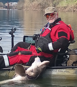
jed with a spring Big Mack

Topic: NW Marine Weather observations and forecasts  (Read 2463 times)

0 Members and 1 Guest are viewing this topic.

demonick

  • Sturgeon
  • *******
  • Domenick Venezia, Author
  • Date Registered: Apr 2009
  • Posts: 2835
Northwest Association of Networked Ocean Observing Systems
http://www.nanoos.org/

Data Explorer NVS/View all Assets
http://www.nanoos.org/nvs/nvs.php?section=NVS-Assets

There is a lot of information here.  I particularly like the wind speed overlay and NAM forecast. 

Also you can zoom in on one observation station, e.g., buoy APL-UW-NPB-1, just south of Wells Point.  Puget Sound has observation points at Mukilteo, Wells Point, West Point, Alki Point, Elliot Bay, ...

There are observation stations all over the Pacific Coast, WA, OR, N-CA, SW-BC.

Wave height and period, water temp and currents.  Zoom out for WA wave data as it looks like it comes mostly from a buoy about 30 nm offshore of La Push.
« Last Edit: September 02, 2011, 09:08:46 AM by demonick »
demonick
Author, Linc Malloy Legacies -- Action/Adventure/Thrillers
2021 Chanticleer Finalist - Global Thriller Series & High Stakes Fiction
Rip City Legacy, Book 6 latest release!
DomenickVenezia.com