Welcome, Guest. Please login or register.
July 03, 2025, 11:36:18 AM

Login with username, password and session length

Recent Topics

[Today at 11:06:33 AM]

[July 01, 2025, 03:13:39 PM]

[July 01, 2025, 08:55:15 AM]

[July 01, 2025, 06:42:20 AM]

[July 01, 2025, 04:40:08 AM]

[June 28, 2025, 03:25:42 PM]

[June 26, 2025, 11:15:57 PM]

[June 25, 2025, 02:09:58 PM]

[June 24, 2025, 02:37:40 AM]

[June 22, 2025, 11:03:48 AM]

[June 13, 2025, 07:00:13 PM]

[June 13, 2025, 02:51:47 PM]

[June 12, 2025, 06:51:40 AM]

[June 06, 2025, 09:02:38 AM]

[June 04, 2025, 11:55:53 AM]

Picture Of The Month


Guess who's back?
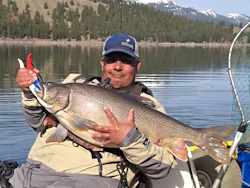
jed with a spring Big Mack

Topic: 2013 ORC OFFICIAL ANNOUNCEMENT  (Read 68514 times)

0 Members and 1 Guest are viewing this topic.

coosbayyaker

  • Sturgeon
  • *******
  • "Hooky Thing"
  • Location: Coos Bay Oregon
  • Date Registered: Oct 2007
  • Posts: 3862
  What color will my new Outback be ? after I win it..... ;D ;D

It will be the same color as it is before you win it... ;)
See ya on the water..
Roy


PNW

  • Teutrowenia pellucida (Googly-eyed glass squid)
  • Sturgeon
  • *******
  • Paul
  • My Facebook page
  • Location: Eugene, OR
  • Date Registered: Sep 2008
  • Posts: 2451
Talked w/ Jammer & it sounds like my issue w/ the north boundary will be resolved. I'm happy  ;D thanks guys


  • Life is analog. Don't be digital.
  • Location: Seattle, WA
  • Date Registered: May 2013
  • Posts: 90
  What color will my new Outback be ? after I win it..... ;D ;D

It will be the same color as it is before you win it... ;)

Aw, you beat me to it.


Jammer

  • KayakFishingOregon.com
  • Sturgeon
  • *******
  • Kayak Fishing Oregon
  • Location: Portland, Oregon
  • Date Registered: Jul 2009
  • Posts: 1489
If your name is on this list, I've received you're payment and you are officially "paid up" for the ORC13.. Don't be the last to sign up as we only have captains bags for the first 100 that are paid up. Only 5 weeks to go!
 
James Case
David Mason
John Kriel
Brian Steves
Roy Marcum
Dudi Wittwer
Noah Kriel
Andrew Upson
Paul Tanca
Mark Collett
Sam McDowell
Erik Schmidt
Sherman Case
Justin Flynn
Patrick Acree
John Hayashibara
Steve Vandyke
David Sharp (x 2)

« Last Edit: June 05, 2013, 04:51:13 PM by Jammer »
• Stohlquist • Team Daiwa • Yakima Bait Company

2015 Hobie Fishing Team "Top Gun"
2012 Hobie Worlds Team USA - 19th place
2012 Oregon Rockfish Classic – 1st place
2010 Oregon Rockfish Classic - 1st place
2010 Cape Dis. Dungie Tourney - 1st place

KAYAK FISHING OREGON
www.youtube.com/jmrischer


Northwoods

  • Sturgeon
  • *******
  • Formerly sumpNZ
  • Location: Sedro-Woolley, WA
  • Date Registered: Nov 2011
  • Posts: 2308
- NO FISHING IS ALLOWED IN THE CHANNEL BETWEEN THE BELL BUOY AND THE HARBOR ENTRANCE!
 - SOUTHERN FISHING BOUNDARY = WHALE COVE
 - NORTHERN FISHING BOUNDARY = RABBIT ROCK
[/size]


Would you mind clarifying those boundaries, please.  I am not familiar enough with the area to know where Rabbit Rock is, and it is not labled on Google Maps, or the Deep Zoom charts.  Also, does the southern boundary include all of Whale Cove, or to the mid-line of the cove, or what? 

Perhaps it might be helpful to define a pair of latitude lines so that those of us with GPS's can make sure we're on the correct side of the line in addition to the geographical references?  E.g. the north end might be at N 44deg 49' 50" (the tip of the spit on what the maps lable as Govt Pt), and the south end at N 44deg  47' 15" (southern end of Whale Cove).  Or whatever the appropriate coordinates might be.
Formerly sumpNZ
2012 ORC 5th Place


Jammer

  • KayakFishingOregon.com
  • Sturgeon
  • *******
  • Kayak Fishing Oregon
  • Location: Portland, Oregon
  • Date Registered: Jul 2009
  • Posts: 1489
- NO FISHING IS ALLOWED IN THE CHANNEL BETWEEN THE BELL BUOY AND THE HARBOR ENTRANCE!
 - SOUTHERN FISHING BOUNDARY = WHALE COVE
 - NORTHERN FISHING BOUNDARY = RABBIT ROCK
[/size]


Would you mind clarifying those boundaries, please.  I am not familiar enough with the area to know where Rabbit Rock is, and it is not labled on Google Maps, or the Deep Zoom charts.  Also, does the southern boundary include all of Whale Cove, or to the mid-line of the cove, or what? 

Perhaps it might be helpful to define a pair of latitude lines so that those of us with GPS's can make sure we're on the correct side of the line in addition to the geographical references?  E.g. the north end might be at N 44deg 49' 50" (the tip of the spit on what the maps lable as Govt Pt), and the south end at N 44deg  47' 15" (southern end of Whale Cove).  Or whatever the appropriate coordinates might be.
Great question! Bsteves is currently in the process of creating a map and should have it up soon. We can make it pretty much as detailed as you guys want. He will be posting the map as soon as he is finished.

To answer your question about Whale Cove, yes our boundaries will include all of the cove. The border will be at the very south end of the cove.

The borders should be much more clear at both ends as soon as he gets it posted.
« Last Edit: June 05, 2013, 01:05:33 PM by Jammer »
• Stohlquist • Team Daiwa • Yakima Bait Company

2015 Hobie Fishing Team "Top Gun"
2012 Hobie Worlds Team USA - 19th place
2012 Oregon Rockfish Classic – 1st place
2010 Oregon Rockfish Classic - 1st place
2010 Cape Dis. Dungie Tourney - 1st place

KAYAK FISHING OREGON
www.youtube.com/jmrischer


bsteves

  • Fish Nerd
  • Administrator
  • Sturgeon
  • *****
  • Better fishing through science
  • Location: Portland, OR
  • Date Registered: Feb 2007
  • Posts: 4584
We'll be providing a Google Map link, way points, PDF for paper map, and latitudes for the North and South boundaries.  If you really want, you can download the KML from the Google Map and convert it for use with your GPS or chart plotter (assuming your system is capable of uploading waypoints).

http://www.gpsvisualizer.com/gpsbabel/

Input the KML file and output to something that you can upload to your GPS.  If you can choose a format that allows for waypoints, tracks, and routes then you'll basically get the whole map on your fish finder/gps.

Here's a draft Google map.  We might refine this a bit before the event.
Link:
https://www.google.com/maps/ms?msid=200698638316756037338.0004de08821f60e986ca9&msa=0

Map:

View Oregon Rockfish Classic Map in a larger map
“People say nothing is impossible, but I do nothing every day.”

― A.A. Milne, Winnie-the-Pooh


polepole

  • Administrator
  • Sturgeon
  • *****
  • NorthWest Kayak Anglers
  • Location: San Jose, CA :(
  • Date Registered: Apr 2006
  • Posts: 10099
I still think we need to be a little clearer with the "channel".  Can you draw a line from the buoy to the first point to the north, then fill in everything in that NE channel.  No one needs to be fishing in there anyways.  It will be easy to sight between the buoy and the point, and the buoy and the Depoe Bay mouth.  How does that sound?

-Allen


bsteves

  • Fish Nerd
  • Administrator
  • Sturgeon
  • *****
  • Better fishing through science
  • Location: Portland, OR
  • Date Registered: Feb 2007
  • Posts: 4584
Sure.  Let me know of any other refinements you'd like to see.
“People say nothing is impossible, but I do nothing every day.”

― A.A. Milne, Winnie-the-Pooh


bsteves

  • Fish Nerd
  • Administrator
  • Sturgeon
  • *****
  • Better fishing through science
  • Location: Portland, OR
  • Date Registered: Feb 2007
  • Posts: 4584
This major point or one of the smaller ones near the mouth?  Refresh map if needed..
“People say nothing is impossible, but I do nothing every day.”

― A.A. Milne, Winnie-the-Pooh


polepole

  • Administrator
  • Sturgeon
  • *****
  • NorthWest Kayak Anglers
  • Location: San Jose, CA :(
  • Date Registered: Apr 2006
  • Posts: 10099
You got the one I was thinking.  What do you think of that?

-Allen


Lee

  • Iris
  • Sturgeon
  • *******
  • Fuck Cancer!
  • Location: Graham, WA
  • Date Registered: Jul 2009
  • Posts: 6091
Um, you guys eliminated the area where everyone stayed to get out of the current last year.  That north point of the red zone is several hundred yards away from the channel. 

Sent from my DROID RAZR using Tapatalk 2


Noah

  • Sturgeon
  • *******
  • Cabby Strong!
  • Location: Tigard
  • Date Registered: Mar 2011
  • Posts: 3597
Um, you guys eliminated the area where everyone stayed to get out of the current last year.  That north point of the red zone is several hundred yards away from the channel. 

Sent from my DROID RAZR using Tapatalk 2
1+. Just make it more of a direct line from the hole to the first buoy.


bsteves

  • Fish Nerd
  • Administrator
  • Sturgeon
  • *****
  • Better fishing through science
  • Location: Portland, OR
  • Date Registered: Feb 2007
  • Posts: 4584
I added a  ~100 m swath between the harbor and the bell buoy as second proposal.

“People say nothing is impossible, but I do nothing every day.”

― A.A. Milne, Winnie-the-Pooh


bsteves

  • Fish Nerd
  • Administrator
  • Sturgeon
  • *****
  • Better fishing through science
  • Location: Portland, OR
  • Date Registered: Feb 2007
  • Posts: 4584
I could also make it more rectangular and aligned west to east so that we'd have defined West, North, and South boundaries coordinates.
“People say nothing is impossible, but I do nothing every day.”

― A.A. Milne, Winnie-the-Pooh