Welcome, Guest. Please login or register.
July 03, 2025, 07:51:49 PM

Login with username, password and session length

Recent Topics

[Today at 11:06:33 AM]

[July 01, 2025, 03:13:39 PM]

[July 01, 2025, 08:55:15 AM]

[July 01, 2025, 06:42:20 AM]

[July 01, 2025, 04:40:08 AM]

[June 28, 2025, 03:25:42 PM]

[June 26, 2025, 11:15:57 PM]

[June 25, 2025, 02:09:58 PM]

[June 24, 2025, 02:37:40 AM]

[June 22, 2025, 11:03:48 AM]

[June 13, 2025, 07:00:13 PM]

[June 13, 2025, 02:51:47 PM]

[June 12, 2025, 06:51:40 AM]

[June 06, 2025, 09:02:38 AM]

[June 04, 2025, 11:55:53 AM]

Picture Of The Month


Guess who's back?
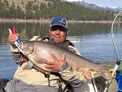
jed with a spring Big Mack

Topic: 2013 ORC OFFICIAL ANNOUNCEMENT  (Read 68524 times)

0 Members and 1 Guest are viewing this topic.

Northwoods

  • Sturgeon
  • *******
  • Formerly sumpNZ
  • Location: Sedro-Woolley, WA
  • Date Registered: Nov 2011
  • Posts: 2308
I'd be OK with either option 2 or 3, with a preference for option 2.  Main issue here is to keep people from fishing in the traffic lane between the bouy and the hole.  Option 2 accomplishes that.  Though I can see the point in the expanded area of Option 3, and would be OK either way.
Formerly sumpNZ
2012 ORC 5th Place


Lee

  • Iris
  • Sturgeon
  • *******
  • Fuck Cancer!
  • Location: Graham, WA
  • Date Registered: Jul 2009
  • Posts: 6091
It's fairly easy to see if you're between either wall of the hole and the bouy.  The dark blue shaded area is sufficient  imo

Sent from my DROID RAZR using Tapatalk 2


polepole

  • Administrator
  • Sturgeon
  • *****
  • NorthWest Kayak Anglers
  • Location: San Jose, CA :(
  • Date Registered: Apr 2006
  • Posts: 10099
Um, you guys eliminated the area where everyone stayed to get out of the current last year.  That north point of the red zone is several hundred yards away from the channel. 

Sent from my DROID RAZR using Tapatalk 2
1+. Just make it more of a direct line from the hole to the first buoy.

Doesn't that line go to the inside of the kelp bed, or maybe right through it?  That was my intent.  Although we could just say from the red buoy to the southern tip of the kelp bed, along the inside of the kelp bed and inward towards shore.

The issue I'm trying to address is to make things crystal clear and objective while out on the water.  Saying XYZ yards from something isn't very clear on the water as distances are deceiving.

-Allen


polepole

  • Administrator
  • Sturgeon
  • *****
  • NorthWest Kayak Anglers
  • Location: San Jose, CA :(
  • Date Registered: Apr 2006
  • Posts: 10099
BTW, last year a lot of the boats were cutting that corner at the kelp on the way north.  We really should avoid fishing that spot if possible.  Last year we all bunched up there in the fog at the start of the morning, and had boats running through us.

-Allen


Lee

  • Iris
  • Sturgeon
  • *******
  • Fuck Cancer!
  • Location: Graham, WA
  • Date Registered: Jul 2009
  • Posts: 6091
There is good fishing (particularly for noobs) just outside the hole, north of the sea wall.    It's pot of the way, safe, and great for those who might get overwhelmed further out.  Art caught his fish on that area, and there were probably six people that fished that spot, and only that spot last year.

Sent from my DROID RAZR using Tapatalk 2


polepole

  • Administrator
  • Sturgeon
  • *****
  • NorthWest Kayak Anglers
  • Location: San Jose, CA :(
  • Date Registered: Apr 2006
  • Posts: 10099
There is good fishing (particularly for noobs) just outside the hole, north of the sea wall.    It's pot of the way, safe, and great for those who might get overwhelmed further out.  Art caught his fish on that area, and there were probably six people that fished that spot, and only that spot last year.

Sent from my DROID RAZR using Tapatalk 2

OK. Then how about form the southern tip of the kelp bed to the hole ... that would mark the northern edge of the "channel".

-Allen


Lee

  • Iris
  • Sturgeon
  • *******
  • Fuck Cancer!
  • Location: Graham, WA
  • Date Registered: Jul 2009
  • Posts: 6091
I can't remember where the kelp beds are.  Could use some Lingbanger input on this.

Sent from my DROID RAZR using Tapatalk 2


Justin

  • Sturgeon
  • *******
  • Location: Baker City, OR
  • Date Registered: May 2011
  • Posts: 1900
I thought "the channel" was pretty obvious once you were out there. 

Have we had such a bad problem with people fishing in the channel in the past that this needs to be debated and specific spots set in stone?
aka - JoeSnuffy

Stand UP! Stand Up and Shout!!!

http://www.youtube.com/user/OutdoorsJustin?feature=mhee


polepole

  • Administrator
  • Sturgeon
  • *****
  • NorthWest Kayak Anglers
  • Location: San Jose, CA :(
  • Date Registered: Apr 2006
  • Posts: 10099
I can't remember where the kelp beds are.  Could use some Lingbanger input on this.

Sent from my DROID RAZR using Tapatalk 2

North of the buoy across the channel!

-Allen


polepole

  • Administrator
  • Sturgeon
  • *****
  • NorthWest Kayak Anglers
  • Location: San Jose, CA :(
  • Date Registered: Apr 2006
  • Posts: 10099
I thought "the channel" was pretty obvious once you were out there. 

Have we had such a bad problem with people fishing in the channel in the past that this needs to be debated and specific spots set in stone?

Short answer, yes.  I guess I wouldn't say it is a "bad" problem.  But it does have the potential to be a bad problem, one we'd much rather just try to avoid.  There have been complaints on both sides.  But remember, we are visitors here and we should take the high road and be as courteous as possible.

And if there is one thing I've learned when running events, it is best to be clear and objective with the rules.

-Allen


rawkfish

  • ORC
  • Sturgeon
  • *
  • Cabby Strong!
  • youtube.com
  • Location: Portland
  • Date Registered: Mar 2009
  • Posts: 4731
It's difficult to use the kelp beds in that are as points of reference IMO.  There are kelp beds that grow both north and south of the channel in that whole bay area and even north and south along the shore.  I have noticed this year that the kelp is showing up in many more places out at PC where I have never seen it grow in prior years.  If it's happening in PC this year than it could very well be happening down at Depoe Bay too.   Also, the area immediately outside of the channel to the north and south can hold a lot of fish, but this place can easily turn into a pretty intense washing machine on agitate with a decent swell, making it very difficult for even the more salty guys around to fish it.  So it should not be relied upon as the place of refuge from big seas. 

I think that by far the most effective way to make sure people are staying out of the channel is to have someone on "Channel Duty" with a GPS that has the waypoints plotted out just doing rounds to make sure people are not fishing where they shouldn't be.  And no, I'm not volunteering myself for this job.  I've got fish to catch.  ;)
                
2011 Angler Of The Year
1st Place 2011 PDX Bass Yakin' Classic
"Fishing relaxes me.  It's like yoga except I still get to kill something."  - Ron Swanson


polepole

  • Administrator
  • Sturgeon
  • *****
  • NorthWest Kayak Anglers
  • Location: San Jose, CA :(
  • Date Registered: Apr 2006
  • Posts: 10099
It's difficult to use the kelp beds in that are as points of reference IMO.  There are kelp beds that grow both north and south of the channel in that whole bay area and even north and south along the shore.  I have noticed this year that the kelp is showing up in many more places out at PC where I have never seen it grow in prior years.  If it's happening in PC this year than it could very well be happening down at Depoe Bay too.   Also, the area immediately outside of the channel to the north and south can hold a lot of fish, but this place can easily turn into a pretty intense washing machine on agitate with a decent swell, making it very difficult for even the more salty guys around to fish it.  So it should not be relied upon as the place of refuge from big seas. 

I think that by far the most effective way to make sure people are staying out of the channel is to have someone on "Channel Duty" with a GPS that has the waypoints plotted out just doing rounds to make sure people are not fishing where they shouldn't be.  And no, I'm not volunteering myself for this job.  I've got fish to catch.  ;)

Realistically I don't think we're going to have a "Channel Guard".  Even with defined markers, it will be hard to judge, other than gross violators.  At the end of the day, we have to rely on the honor system.  And you don't want to be the one subject to ridicule by the masses.  Yes, we will ridicule you!!!   >:D

The kelp bed on the north side comes off that point and runs to the south.   The very southern tip of it should be easily identifiable.   There is a relatively hard stop as the channel drops off fast there, deeper than kelp can grow,  like straight to 90 feet.  I'd think that the boats use it as a reference too, as they have to go around to the south of it anyways (they aren't going to cut through that kelp bed, well, the smart boaters anyway).  Of course there is leeway in this ... the southern point to the east or the southern point to the west?  I can't think of another reference point there, short of sinking a buoy there too, but I don't want to be the one sinking a buoy at the edge of the channel.

-Allen


rawkfish

  • ORC
  • Sturgeon
  • *
  • Cabby Strong!
  • youtube.com
  • Location: Portland
  • Date Registered: Mar 2009
  • Posts: 4731
Realistically I don't think we're going to have a "Channel Guard".  Even with defined markers, it will be hard to judge, other than gross violators.  At the end of the day, we have to rely on the honor system.  And you don't want to be the one subject to ridicule by the masses.  Yes, we will ridicule you!!!   >:D

The kelp bed on the north side comes off that point and runs to the south.   The very southern tip of it should be easily identifiable.   There is a relatively hard stop as the channel drops off fast there, deeper than kelp can grow,  like straight to 90 feet.  I'd think that the boats use it as a reference too, as they have to go around to the south of it anyways (they aren't going to cut through that kelp bed, well, the smart boaters anyway).  Of course there is leeway in this ... the southern point to the east or the southern point to the west?  I can't think of another reference point there, short of sinking a buoy there too, but I don't want to be the one sinking a buoy at the edge of the channel.

-Allen

True, I meant to say after that that it does seem like an over-the-top way of getting it done.  Most effective, but a bit over-the-top.

Yes, I know which kelp line you're referring to.  But since there are many kelp lines out there, I feel it will be necessary for people new to the area, and there are always plenty, to make sure they're looking at the right kelp line.  Each year there are people at the ORC that are new to the ocean, let alone Depoe Bay and I can see how it could be tough to get your bearings in a place you've only maybe glanced at an overhead map of a couple of times.  I'm half tempted to argue that if you're between the first buoy and the shoreline then you're not in eligible waters, but maybe that's going to far to try and make things idiot-proof.  We can only do so much.  I like the idea of public shame though.  That usually gets the job done.   >:D
                
2011 Angler Of The Year
1st Place 2011 PDX Bass Yakin' Classic
"Fishing relaxes me.  It's like yoga except I still get to kill something."  - Ron Swanson


polepole

  • Administrator
  • Sturgeon
  • *****
  • NorthWest Kayak Anglers
  • Location: San Jose, CA :(
  • Date Registered: Apr 2006
  • Posts: 10099
I'm half tempted to argue that if you're between the first buoy and the shoreline then you're not in eligible waters, but maybe that's going to far to try and make things idiot-proof.  We can only do so much.  I like the idea of public shame though.  That usually gets the job done.   >:D

 I started down that path with my thinking.  But you still need a western line.  A north/south line through the buoy doesn't work as it is "outside" the bay.  That's when I thought about the point to the north.    I wanted to just make it simple and draw all the way to the point and say to the east of that, but as Lee pointed out, there is fishable and safe waters within that triangle.  I still think this can sort of work, at least if you draw a line from the buoy towards the northern point and stop it at the first kelp bed you hit.  The northern boundary of the channel would be from that point to the hole.  The western boundary would be from that point to the buoy.  The southern boundary would be from the buoy to the hole.  But I'm not actually sure if where the "first kelp bed you hit".  It could be on the outside, cutting out some decent fishing area outside the channel.  Hence my latest thought ... the southern point of that kelp line.  That kelp line is the furthest outside anyway.  I mean, the big kelp bed coming off the point.  I'm sure there are patches outside of it.  Grr ...

-Allen


PNW

  • Teutrowenia pellucida (Googly-eyed glass squid)
  • Sturgeon
  • *******
  • Paul
  • My Facebook page
  • Location: Eugene, OR
  • Date Registered: Sep 2008
  • Posts: 2451
+1 for option #2